Area Overview for L69 7WW
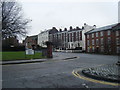
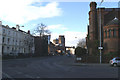
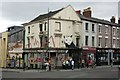
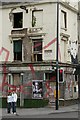
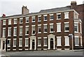
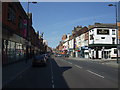
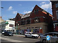
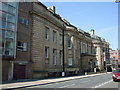
Photos of L69 7WW


Area Information
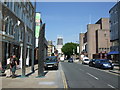
Living in L69 7WW means being part of a tightly packed residential cluster in England, where 2,266 people reside across 2,970 square metres. This small area has a population density of 763,049 people per square kilometre, reflecting a compact, urban environment. The community is dominated by young adults aged 15–29, with a median age of 22. Daily life here is shaped by proximity to transport links and amenities, though the area’s small size means it is best suited for those prioritising convenience over space. The housing stock consists mostly of flats, with only 23% of residents owning their homes. This suggests a transient population, likely drawn by nearby educational or employment opportunities. L69 7WW sits near key infrastructure, including railway stations and ferry terminals, making it a practical base for commuters. While the area lacks natural landscapes or protected sites, its density and connectivity offer a distinct urban rhythm, ideal for those seeking proximity to services and a dynamic, youthful demographic.
- Area Type
- Postcode
- Area Size
- 2970 m²
- Population
- 2266
- Population Density
- 7973 people/km²
The property market in L69 7WW is defined by its high density and limited housing stock. With 23% of residents owning their homes, the area is predominantly a rental market, dominated by flats. This suggests a lack of larger, family-oriented properties, which may limit appeal for those seeking long-term, owner-occupied homes. The small size of the area means the housing stock is constrained, potentially leading to competition for available properties. For buyers, this presents a challenge: the limited supply of flats and the absence of detached or semi-detached homes may make L69 7WW unsuitable for those prioritising space or investment in property. However, the proximity to transport links and amenities could offset these drawbacks for renters or those seeking short-term accommodation. Prospective buyers should consider the area’s transient nature and whether its compact, urban layout aligns with their needs.
House Prices in L69 7WW
Showing 1 properties
| Address | Type | Beds | Baths | Last Sale Price | Last Sale Date | |
|---|---|---|---|---|---|---|
| Liverpool University Arts Reading And Lecture Rooms, Bedford Street South, Liverpool, L69 7WW | commercial | - | - | - | - |
Energy Efficiency in L69 7WW
L69 7WW offers a range of amenities within walking or short transit distance. Retail options include Heron Liverpool, Tesco Myrtle, and Co-op Liverpool, providing essentials and convenience for daily shopping. The area’s proximity to rail stations like Liverpool Central Loop Line and Edge Hill Railway Station ensures easy access to the city’s business and cultural hubs. Ferry terminals at Liverpool Pier Head and Woodside Birkenhead add flexibility for travel to nearby towns and islands. While the area lacks extensive green spaces or leisure facilities, its density and connectivity support a lifestyle focused on urban convenience. Residents can access dining, retail, and transport without long commutes, though the absence of parks or recreational areas may be a drawback for those prioritising outdoor space. The mix of retail and transport infrastructure makes L69 7WW practical for those seeking a compact, service-rich environment.
Amenities
Schools
Residents of L69 7WW have access to two notable educational institutions. St Saviour’s CofE Junior Mixed and Infant School provides primary education, while the University of Liverpool Mathematics School caters to sixth-form students. The presence of both a primary school and a specialist sixth-form institution suggests a mix of local and higher-education needs. Families with young children may benefit from the primary school’s proximity, though the absence of secondary schools in the immediate area could require commuting. The University of Liverpool Mathematics School, focused on advanced mathematics, may attract students seeking specialist pathways. However, the data does not include Ofsted ratings or academic performance metrics, so prospective families should conduct further research. Overall, the school mix reflects a blend of local and tertiary education options, though the lack of comprehensive secondary schooling is a consideration for families requiring full-cycle education.
| Rank | School | Type | Entry gender | Ages |
|---|
Explore more schools in this area
Go to Schools tabDemographics
The population of L69 7WW is overwhelmingly young, with a median age of 22 and 76% of residents falling within the 15–29 age range. This demographic skew indicates a community centred on students, recent graduates, or young professionals. Home ownership is low at 23%, suggesting most residents rent, which aligns with the prevalence of flats as the primary accommodation type. The predominant ethnic group is White, though specific data on diversity is not provided. The high proportion of young adults shapes the area’s character, with social and economic activity likely focused on nearby educational institutions or urban hubs. The lack of family-oriented housing and the high proportion of renters imply a transient population, which may affect the sense of long-term community cohesion. For those considering L69 7WW, the demographic profile suggests a lively, youthful environment but one that may lack the stability of more established neighbourhoods.
Household Size
Accommodation Type
Tenure
Ethnic Group
Religion
Household Composition
Age
Household Deprivation
NS-SEC
Explore more demographic insights in this area
Go to Demographics tabPlanning
Planning Constraints
- Flood RiskPremium
- Ramsar Wetland SitesPremium
- Area of Outstanding Natural BeautyPremium
- Protected Nature ReservePremium
- Protected WoodlandPremium