Area Overview for L69 7BL
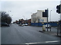
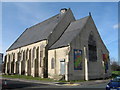
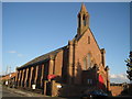
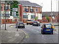
Photos of L69 7BL


Area Information
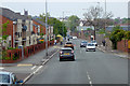
Living in L69 7BL means being part of a small, tightly knit residential cluster in England, home to 2,697 people. This area is defined by its proximity to Liverpool’s transport networks, with multiple railway stations, ferry terminals, and retail hubs within reach. The community is young, with a median age of 22 and a majority of residents aged 15–29. Daily life here balances practicality with accessibility — residents can walk to shops, catch a train to central Liverpool, or take a ferry to nearby destinations. The area’s compact size means amenities are close, but it is not a high-density urban space. While flood risk is low, crime rates are around average, requiring standard security measures. For those seeking a base near transport links and a mix of local and independent schools, L69 7BL offers a functional, if modest, living environment. Its small footprint means it is not a sprawling suburb, but a focused cluster of homes with clear connections to surrounding cities and services.
- Area Type
- Postcode
- Area Size
- Not available
- Population
- 2697
- Population Density
- 5657 people/km²
The property market in L69 7BL is characterised by a low home ownership rate of 19%, suggesting that most residents rent rather than own their homes. The accommodation type is predominantly houses, which is unusual for a small postcode area, hinting at a mix of larger properties or family homes. This contrasts with typical urban rental markets, where flats or apartments are more common. The limited number of homes and high proportion of renters may make the area less attractive for long-term buyers seeking stability, though proximity to transport and amenities could offset this. For those considering purchase, the small size of the area means competition for properties is likely, and buyers should focus on nearby zones with similar connectivity. The predominance of houses may appeal to families, but the low ownership rate indicates a transient population, which could affect property value trends.
House Prices in L69 7BL
No properties found in this postcode.
Energy Efficiency in L69 7BL
The lifestyle in L69 7BL is shaped by its proximity to retail, transport, and leisure facilities. Residents can access major supermarkets like Tesco Merseyside and Iceland Wavertree, as well as local shops such as Farmfoods Wavertree, ensuring daily essentials are within reach. The area’s rail network connects to Liverpool’s central stations, while ferry terminals offer trips to nearby destinations like Birkenhead or across the Irish Sea. For travel beyond the region, Liverpool John Lennon Airport is a short journey away. The presence of multiple schools and transport links suggests a focus on practicality, though the area lacks large parks or cultural venues. The mix of retail and transport options means daily life is efficient, with opportunities for commuting, shopping, or leisure trips without long journeys.
Amenities
Schools
Residents of L69 7BL have access to a range of primary schools, including St Anne’s Catholic Primary School, which holds an Ofsted rating of good, and St Anne’s RC Infants’ and Junior Schools. A second primary school, Nugent RC Boys’ Comprehensive School, is also nearby, though its Ofsted rating is not specified. For independent education, Christian Fellowship School offers a good Ofsted rating. The mix of state and independent schools provides families with choices, though the absence of secondary schools in the immediate area may require commuting to larger centres like Liverpool. The presence of multiple primary schools suggests a focus on early education, but parents should consider the need for secondary schooling when evaluating the area’s suitability for growing families.
| Rank | School | Type | Entry gender | Ages |
|---|
Explore more schools in this area
Go to Schools tabDemographics
The population of L69 7BL is overwhelmingly young, with a median age of 22 and 19% of residents owning their homes. This suggests a community where rental properties dominate, reflecting the area’s character as a transient or student-heavy neighbourhood. The most common age range is 15–29 years, indicating a presence of students, young professionals, or families with children. Accommodation is primarily houses, though the low home ownership rate implies many residents live in rented properties. The predominant ethnic group is White, and no specific data on deprivation is provided, though the 19% ownership rate may correlate with lower long-term stability. For families, the mix of primary schools and a small independent school offers options, but the lack of secondary education facilities nearby may require commuting. The area’s youth demographic shapes its social dynamics, with a focus on mobility and access to broader opportunities beyond the immediate postcode.
Household Size
Accommodation Type
Tenure
Ethnic Group
Religion
Household Composition
Age
Household Deprivation
NS-SEC
Explore more demographic insights in this area
Go to Demographics tabPlanning
Planning Constraints
- Flood RiskPremium
- Ramsar Wetland SitesPremium
- Area of Outstanding Natural BeautyPremium
- Protected Nature ReservePremium
- Protected WoodlandPremium