Area Overview for L69 3GJ
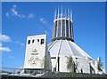
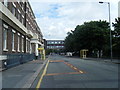
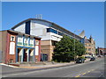
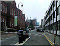
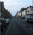
Photos of L69 3GJ


Area Information
Living in L69 3GJ means inhabiting a compact residential cluster in England, where 2,756 people reside across just 1.4 hectares. The area’s density is striking — over 194,923 people per square kilometre — creating a tightly woven community. This postcode is not a sprawling suburb but a focused, small-scale neighbourhood. Daily life here is shaped by proximity to key transport routes and amenities. The population skews young, with a median age of 22, suggesting a dynamic, student-influenced or early-career demographic. While the area lacks expansive green spaces or major landmarks, its strategic location near rail and ferry networks offers mobility. The compact size means residents are likely to know their neighbours, though the high population density may impact privacy. For those seeking a compact, connected environment with access to urban infrastructure, L69 3GJ offers a distinct blend of proximity and practicality. However, the small footprint means the area is best suited for those prioritising convenience over space.
- Area Type
- Postcode
- Area Size
- 1.4 hectares
- Population
- 2756
- Population Density
- 5489 people/km²
The property market in L69 3GJ is characterised by low home ownership and a concentration of flats. With only 17% of residents owning their homes, the area functions primarily as a rental market. The prevalence of flats suggests a focus on compact, efficient living spaces, likely catering to students or young professionals. This small postcode area, covering just 1.4 hectares, means the housing stock is limited in scale. Buyers should consider that property availability may be constrained by the area’s size and the dominance of rental units. For those seeking a home, the market may lean towards short-term or transitional living rather than long-term investment. The flat-centric nature of the area also means buyers should assess whether the layout and size align with their needs, as larger or detached properties are unlikely to be available.
House Prices in L69 3GJ
Showing 3 properties
| Address | Type | Beds | Baths | Last Sale Price | Last Sale Date | |
|---|---|---|---|---|---|---|
| 7 Ashton Street, City Centre, Liverpool, L69 3GJ | Office | - | - | - | - | |
| 5 Ashton Street, City Centre, Liverpool, L69 3GJ | commercial | - | - | - | - | |
| Liverpool University Department Of Electrical Engineering, Brownlow Hill, Liverpool, L69 3GJ | commercial | - | - | - | - |
Energy Efficiency in L69 3GJ
Life in L69 3GJ is shaped by its proximity to retail, transport, and ferry hubs. The area has five retail outlets within reach, including Tesco Liverpool, Co-op University of, and Lidl Central, offering everyday shopping convenience. Rail networks are extensive, with stations like Liverpool Lime Street Low Level and Liverpool Central Loop Line providing easy access to the city and beyond. Ferry terminals such as Liverpool Pier Head and Woodside Birkenhead connect residents to nearby destinations, enhancing mobility. While the data does not mention parks or leisure facilities, the presence of multiple transport options suggests a focus on connectivity over recreational spaces. The compact nature of the area means amenities are tightly clustered, requiring minimal travel for essentials. This setup suits those prioritising accessibility over expansive leisure options.
Amenities
Schools
The nearest school to L69 3GJ is FORO College, an independent institution. No other schools are listed in the data, so this is the sole educational option explicitly referenced. Independent schools often cater to specific age groups or educational philosophies, though details about FORO College’s Ofsted rating or academic performance are not provided. For families, the absence of multiple schools may limit choices, particularly if the needs of children require specific facilities or curricula. Parents should investigate further to determine whether FORO College meets their requirements, as the data does not specify its academic standards or student outcomes. The single-school dynamic suggests a reliance on this one institution for local education.
| Rank | School | Type | Entry gender | Ages |
|---|
Explore more schools in this area
Go to Schools tabDemographics
The community in L69 3GJ is overwhelmingly young, with a median age of 22 and the majority of residents aged 15–29. This suggests a population dominated by students, recent graduates, or young professionals. Home ownership is exceptionally low at 17%, indicating that most residents rent their accommodation. The predominant housing type is flats, reflecting the area’s compact nature and likely development as part of a larger residential complex or converted building. The ethnic composition is predominantly White, though specific diversity metrics are not provided. The high proportion of young adults may correlate with transient living patterns, with residents potentially moving frequently for work or education. The area’s demographic profile suggests a community focused on affordability and accessibility rather than long-term settlement. For buyers, this implies a rental-heavy market with limited opportunities for property investment.
Household Size
Accommodation Type
Tenure
Ethnic Group
Religion
Household Composition
Age
Household Deprivation
NS-SEC
Explore more demographic insights in this area
Go to Demographics tabPlanning
Planning Constraints
- Flood RiskPremium
- Ramsar Wetland SitesPremium
- Area of Outstanding Natural BeautyPremium
- Protected Nature ReservePremium
- Protected WoodlandPremium