Area Overview for L66 7PF
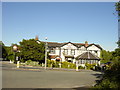
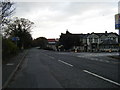
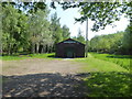
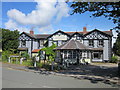
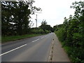
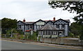
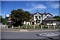
Photos of L66 7PF

Area Information
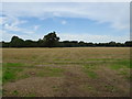
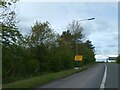
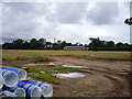
Living in L66 7PF means inhabiting a small, tightly knit residential cluster in the Wirral Peninsula, part of Cheshire East. With a population of 1,399 spread across 169 people per square kilometre, the area feels quiet and unassuming, far from urban sprawl. Historically, the village of Willaston and nearby Thornton Hough were part of a broader network of townships that shaped the region’s agricultural past. Today, the area retains a village character, with homes predominantly owner-occupied and a median age of 47 suggesting a stable, mature community. Residents benefit from proximity to both rural tranquillity and practical amenities, including nearby railway stations and two airports within reach. The postcode’s small size means it is easy to navigate, with a focus on local living rather than sprawling development. For those seeking a low-key, family-oriented environment, L66 7PF offers a blend of historical roots and modern convenience, with schools, retail, and green spaces within walking or short driving distance.
- Area Type
- Postcode
- Area Size
- Not available
- Population
- 1399
- Population Density
- 169 people/km²
The property market in L66 7PF is characterised by a high rate of home ownership (82%) and a focus on houses rather than flats or apartments. This reflects a residential area prioritising family-friendly, long-term living over rental or speculative investment. The small size of the postcode means the housing stock is limited, with no indication of recent development or expansion. For buyers, this suggests a stable market with properties likely to retain value due to their scarcity. The predominance of owner-occupied homes also implies a community-oriented environment, where residents are more likely to have lived in the area for years. However, the limited scale of the area means prospective buyers should consider nearby postcodes for broader options, though L66 7PF itself offers a distinct, low-density alternative to larger towns.
House Prices in L66 7PF
No properties found in this postcode.
Energy Efficiency in L66 7PF
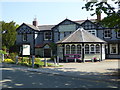
Life in L66 7PF is shaped by its proximity to retail, green spaces, and community amenities. Nearby shops include Tesco Eastham, Morrisons Eastham, and Spar, providing essential grocery and convenience services. For leisure, the area includes Mike Heywood Green and other managed parks, offering space for walking, exercise, or informal gatherings. The village also retains historical touches, such as the restored K6 telephone box converted into a book exchange, reflecting a blend of tradition and community initiative. While the postcode’s small size limits large-scale entertainment options, the nearby railway stations and airports provide access to broader cultural and commercial hubs. The mix of retail, green space, and local character contributes to a self-contained lifestyle, ideal for those valuing convenience without urban density.
Amenities
Schools
Residents of L66 7PF have access to Childer Thornton Primary School, which serves as the main educational institution for the area. The school is listed twice in the data, with an Ofsted rating of ‘outstanding’ noted in one entry, indicating high-quality primary education. For families with children requiring special needs support, Crowthorns Day/Residential Special School, which caters to autism and Asperger’s, is also nearby. This mix of school types ensures that both general and specialist education is available within close proximity. The presence of an outstanding primary school enhances the area’s appeal for families, while the special school provides critical support for those with specific needs. The combination of these institutions suggests a well-rounded educational landscape, though the limited number of schools reflects the small size of the postcode.
| Rank | School | Type | Entry gender | Ages |
|---|
Explore more schools in this area
Go to Schools tabDemographics
The community in L66 7PF is predominantly composed of adults aged 30–64, with a median age of 47. This suggests a mature, established population, likely with long-term ties to the area. Home ownership is high at 82%, indicating a strong sense of local stability and investment. The primary accommodation type is houses, which aligns with the area’s small-scale residential nature. The predominant ethnic group is White, though specific diversity data is not provided. The age profile implies a community with a mix of working-age individuals and retirees, potentially supporting a range of local services. The absence of explicit deprivation data means no direct commentary on economic challenges, but the high home ownership rate and low population density suggest a relatively affluent, low-pressure environment compared to larger urban areas.
Household Size
Accommodation Type
Tenure
Ethnic Group
Religion
Household Composition
Age
Household Deprivation
NS-SEC
Explore more demographic insights in this area
Go to Demographics tabPlanning
Planning Constraints
- Flood RiskPremium
- Ramsar Wetland SitesPremium
- Area of Outstanding Natural BeautyPremium
- Protected Nature ReservePremium
- Protected WoodlandPremium