Area Overview for L66 3SR
Photos of L66 3SR


Area Information
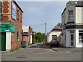
Living in L66 3SR means being part of a small, tightly knit residential cluster in Cheshire West and Chester, near the boundary with the Wirral peninsula. The area has a population of 1,718, reflecting its modest scale and rural character. Historically a village with roots in the Domesday Book, it retains a quiet, settled feel, with a median age of 47 and a community predominantly composed of adults aged 30–64. This suggests a mature demographic, likely with established careers and families. The area’s proximity to Ledsham, a village with a recorded population of 88 in 2001, hints at its historical significance as a rural settlement. Residents benefit from nearby amenities, including multiple retail outlets, rail links, and proximity to Liverpool John Lennon Airport. The low crime risk and absence of environmental constraints like flood zones or protected landscapes make it an attractive choice for those prioritising safety and stability.
- Area Type
- Postcode
- Area Size
- Not available
- Population
- 1718
- Population Density
- 2634 people/km²
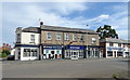
The property market in L66 3SR is dominated by owner-occupied homes, with 89% of properties owned by residents rather than rented. This high ownership rate suggests a stable, long-term resident base with little turnover. The accommodation type is primarily houses, not flats or apartments, which is typical for rural and semi-rural areas. This housing stock is likely to appeal to families and professionals seeking space and privacy. Given the area’s small size and limited development, the market is unlikely to be saturated with new builds, potentially making properties more valuable over time. Buyers should consider the area’s proximity to Ledsham and its surrounding amenities, though the narrow postcode area means the immediate surroundings are also small. The lack of rental properties indicates a community focused on permanence rather than transient living.
House Prices in L66 3SR
No properties found in this postcode.
Energy Efficiency in L66 3SR
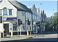
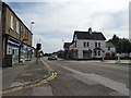
Daily life in L66 3SR is shaped by its proximity to retail, transport, and travel hubs. The area has five notable retail outlets, including Tesco Little and Morrisons Daily, offering convenience for shopping and daily essentials. Rail stations like Little Sutton and Capenhurst provide easy access to regional centres, while the nearby Liverpool John Lennon Airport caters to those requiring air travel. The absence of named parks or leisure facilities in the data suggests that outdoor activities may require venturing beyond the immediate area. However, the retail and transport options contribute to a practical lifestyle, balancing local convenience with regional connectivity. The mix of shops and rail links ensures that residents can meet both routine needs and broader travel requirements without significant effort.
Amenities
Schools
The nearest school to L66 3SR is Sutton Green Primary School, which serves the local community with a primary education offering. The school holds a good Ofsted rating, indicating a reliable standard of teaching and facilities. As the only named school in the data, it suggests that families in the area may need to look beyond L66 3SR for secondary education options. The presence of a primary school with a good rating is a positive factor for parents seeking quality early education, though the absence of secondary schools nearby could influence decisions about long-term residency. The school’s rating and type reflect a focus on foundational learning, which aligns with the area’s demographic of older adults and families with young children.
| Rank | School | Type | Entry gender | Ages |
|---|
Explore more schools in this area
Go to Schools tabDemographics
The population of L66 3SR is 1,718, with a median age of 47, indicating a community skewed towards middle-aged and older residents. The most common age range is adults aged 30–64, suggesting a mix of working professionals and families. Home ownership is high at 89%, reflecting a predominantly owner-occupied area with few rental properties. Accommodation is primarily houses, not flats, which aligns with the area’s rural and semi-rural character. The predominant ethnic group is White, with no specific data on other demographics provided. This profile implies a stable, low-deprivation community where residents are likely to have long-term ties to the area. The absence of significant age or ethnic diversity data means the area’s social fabric remains largely homogeneous, which can foster a sense of familiarity but may limit cultural variety.
Household Size
Accommodation Type
Tenure
Ethnic Group
Religion
Household Composition
Age
Household Deprivation
NS-SEC
Explore more demographic insights in this area
Go to Demographics tabPlanning
Planning Constraints
- Flood RiskPremium
- Ramsar Wetland SitesPremium
- Area of Outstanding Natural BeautyPremium
- Protected Nature ReservePremium
- Protected WoodlandPremium