Area Overview for L65 8JG
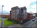
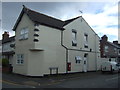
Photos of L65 8JG


Area Information
Living in L65 8JG means being part of a small, defined residential cluster in England, with a population of 1977 people. This area is compact, with a focus on established housing rather than sprawling development. The community likely has a close-knit feel, given the low population density and the presence of nearby amenities. While it is not a major urban centre, its proximity to Ellesmere Port and surrounding towns offers access to services and transport links. The area’s character is shaped by its modest size and the mix of housing types, with a median age of 47 suggesting a mature demographic. Daily life here is likely to be quiet, with a balance between residential comfort and practical connectivity to nearby towns. For those seeking a peaceful yet functional environment, L65 8JG provides a base with straightforward access to essential services, though its small scale means it is best suited to those prioritising convenience over urban vibrancy.
- Area Type
- Postcode
- Area Size
- Not available
- Population
- 1977
- Population Density
- 4808 people/km²
The property market in L65 8JG is characterised by a predominance of houses, with 36% of residents owning their homes. This suggests a mix of owner-occupied and rental properties, though the relatively low home ownership rate indicates that the area may not be a primary destination for long-term buyers seeking to settle. The presence of houses rather than flats or apartments implies a focus on single-family homes, which may appeal to those prioritising space and privacy. However, the small size of the area means the housing stock is limited, and buyers should consider the potential for competition in the local market. For those seeking a home in L65 8JG, the emphasis on houses may align with a desire for traditional residential living, but the low ownership rate also highlights the role of rental properties in meeting demand.
House Prices in L65 8JG
No properties found in this postcode.
Energy Efficiency in L65 8JG
The lifestyle in L65 8JG is shaped by its proximity to retail, transport, and travel hubs. Nearby shops include Farmfoods Ellesmere, Iceland Ellesmere, and Aldi Ellesmere, offering everyday essentials within practical reach. The area’s rail connections, such as Ellesmere Port Railway Station, provide access to broader regional networks, while the nearby Liverpool John Lennon Airport ensures easy travel for those requiring flights. These amenities contribute to a convenient, low-maintenance lifestyle, though the small size of the area means it is best suited to those who prioritise accessibility to larger towns for more specialised services. The combination of retail options and transport links suggests a practical, functional daily life, with opportunities for both local convenience and wider exploration.
Amenities
Schools
The nearest school to L65 8JG is Cambridge Road Community Primary and Nursery School, a primary school with a Good Ofsted rating. This provides a reliable option for families with young children, though the absence of secondary schools in the immediate area may require commuting to nearby towns. The presence of a primary school with a positive rating suggests that the area is suitable for families, but those needing secondary education will need to look further afield. The school’s rating indicates a satisfactory standard of teaching and facilities, which is a key consideration for parents evaluating the area’s suitability for raising children. For buyers prioritising schools, L65 8JG offers a solid foundation but may require additional planning for older children’s education.
| Rank | School | Type | Entry gender | Ages |
|---|
Explore more schools in this area
Go to Schools tabDemographics
The population of L65 8JG is predominantly adults aged 30–64, with a median age of 47. This indicates a mature, settled community, likely with a mix of families and individuals in their middle years. Home ownership is relatively low at 36%, suggesting that a significant proportion of residents rent their homes. The area’s accommodation is primarily houses, which may reflect a preference for larger properties in a residential setting. The predominant ethnic group is White, with no specific data on other demographics provided. The absence of detailed diversity statistics means the community’s composition is not fully defined, but the age profile and home ownership rate suggest a population that is stable and possibly less transient than younger, more rental-focused areas. This demographic profile may influence local services, with amenities tailored to adult needs rather than those of children or elderly residents.
Household Size
Accommodation Type
Tenure
Ethnic Group
Religion
Household Composition
Age
Household Deprivation
NS-SEC
Explore more demographic insights in this area
Go to Demographics tabPlanning
Planning Constraints
- Flood RiskPremium
- Ramsar Wetland SitesPremium
- Area of Outstanding Natural BeautyPremium
- Protected Nature ReservePremium
- Protected WoodlandPremium