Area Overview for L64 3UT
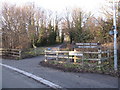
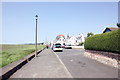
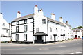
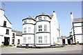
Photos of L64 3UT


Area Information
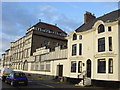
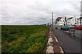
Living in L64 3UT means being part of a small, tightly knit residential cluster in Neston, a historic market town in Cheshire. With a population of 2,046 and a density of 202 people per square kilometre, the area retains a quiet, rural character despite its proximity to the Wirral Peninsula. Neston’s name derives from Old Norse, reflecting its ancient roots as a settlement near a headland that once jutted into the Dee Estuary. Today, it is a tranquil town with a strong sense of history, evidenced by its 14th-century Parish Church of St Mary and St Helen and its 1889 Town Hall. The area is served by five nearby railway stations, including Neston and Heswall, offering regular connections to Liverpool, Chester, and beyond. Daily life here balances historical charm with modern convenience, from its Friday market and monthly Farmer’s Market to the proximity of major retailers like Sainsburys and Tesco. The low crime risk and absence of environmental constraints make it an attractive option for those seeking a peaceful yet accessible lifestyle.
- Area Type
- Postcode
- Area Size
- Not available
- Population
- 2046
- Population Density
- 202 people/km²
The property market in L64 3UT is dominated by owner-occupied homes, with 87% of properties in private hands. The accommodation type is predominantly houses, which is typical of a rural and semi-rural area with limited high-density development. This suggests a market skewed towards family homes and larger properties rather than apartments or flats. Given the small size of the postcode area and its focus on residential clusters, the housing stock is likely to be older, reflecting Neston’s historical character. Buyers should expect a limited number of properties for sale, as the area is not a major urban centre. The high home ownership rate also means fewer rental options, making it less attractive to those seeking short-term lets. For those considering purchase, the emphasis on houses may appeal to buyers prioritising space and a connection to the surrounding countryside, though the lack of newer developments could mean limited modern housing choices.
House Prices in L64 3UT
No properties found in this postcode.
Energy Efficiency in L64 3UT
Residents of L64 3UT have access to a range of local amenities within practical reach. The area is served by five retail outlets, including Aldi Neston, Sainsburys Neston, and Tesco Neston, ensuring everyday shopping needs are met. Nearby railway stations such as Neston and Heswall provide regular connections to surrounding towns and cities, enhancing mobility. The town’s historic character is complemented by its ongoing market traditions, with a Friday market and monthly Farmer’s Market offering fresh produce and local goods. While specific parks or leisure facilities are not detailed in the data, the area’s low population density suggests ample green space. The combination of retail convenience, historical sites, and transport links creates a lifestyle that balances practicality with a sense of community. For those valuing accessibility and a connection to local heritage, L64 3UT offers a straightforward, low-stress daily routine.
Amenities
Schools
| Rank | School | Type | Entry gender | Ages |
|---|
Explore more schools in this area
Go to Schools tabDemographics
The community in L64 3UT is predominantly elderly, with a median age of 47 and the 65+ age group forming the most common demographic. Home ownership is high, at 87%, reflecting a stable, long-term resident base. The area is characterised by houses rather than flats, which aligns with its rural and semi-rural setting. The predominant ethnic group is White, though no specific data on diversity or deprivation levels is provided. This demographic profile suggests a mature population with established roots, likely prioritising security and familiarity. The high home ownership rate indicates limited rental activity, meaning the housing market is more reflective of owner-occupied properties. For buyers, this implies a focus on family homes or properties suited to long-term living rather than short-term investment. The absence of younger households may also mean fewer amenities tailored to children, though the area’s historical character and low crime risk appeal to retirees and those seeking a quieter lifestyle.
Household Size
Accommodation Type
Tenure
Ethnic Group
Religion
Household Composition
Age
Household Deprivation
NS-SEC
Explore more demographic insights in this area
Go to Demographics tabPlanning
Planning Constraints
- Flood RiskPremium
- Ramsar Wetland SitesPremium
- Area of Outstanding Natural BeautyPremium
- Protected Nature ReservePremium
- Protected WoodlandPremium