Area Overview for L64 3UL
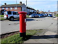
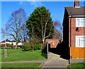
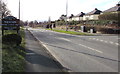
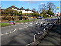
Photos of L64 3UL

Area Information
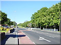
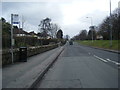
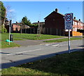
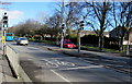
Living in L64 3UL means being part of a small, tightly knit residential cluster in Neston, a historic market town in Cheshire. With a population of 1,665 and a density of 378 people per square kilometre, the area balances compact living with a tranquil, countryside setting. Neston’s name derives from Old Norse, reflecting its ancient roots as a settlement near a promontory. Today, it retains its market town character, hosting a Friday market and monthly Farmer’s Market, alongside historic landmarks like the 14th-century Parish Church of St Mary and St Helen. The area’s appeal lies in its blend of heritage and modern convenience, with nearby amenities and rail links connecting to Birkenhead and Wrexham. For those seeking a peaceful yet connected lifestyle, L64 3UL offers a snapshot of a town where history meets everyday life, with no major planning constraints or environmental risks to disrupt its charm.
- Area Type
- Postcode
- Area Size
- Not available
- Population
- 1665
- Population Density
- 378 people/km²
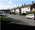
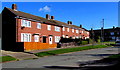
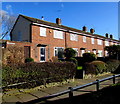
The property market in L64 3UL is characterised by a high rate of home ownership—66% of residents own their homes—suggesting a stable, long-term demographic. The predominant accommodation type is houses, which aligns with the area’s historic and suburban character. This contrasts with rental-heavy markets, indicating that properties here are likely family homes rather than short-term lets. Given the small postcode area and its integration with Neston’s broader residential stock, buyers should expect a limited inventory of properties. The focus on houses may appeal to those prioritising space and privacy, though the market’s size means competition for available homes could be keen.
House Prices in L64 3UL
No properties found in this postcode.
Energy Efficiency in L64 3UL
Residents of L64 3UL enjoy a mix of retail, dining, and transport options within practical reach. Nearby supermarkets include Aldi Neston, Sainsburys Neston, and Tesco Neston, ensuring everyday shopping needs are met. The area’s rail stations—Neston, Heswall, and Eastham Rake—provide direct links to regional centres. Neston itself retains its historic charm, with markets, the Parish Church, and the 1889 Town Hall offering cultural and social anchors. While specific dining or leisure venues are not detailed in the data, the town’s market heritage and proximity to Cheshire countryside suggest a lifestyle blending tradition with modern convenience.
Amenities
Schools
Residents of L64 3UL have access to a range of primary and secondary education options. Nearby schools include Neston St Mary’s CofE Primary School, Raby Park County Junior School, and Neston High School, which operates as an academy with a Good Ofsted rating. The presence of both primary and secondary institutions within walking or short driving distance makes the area suitable for families at different stages of education. The mix of school types ensures a variety of teaching approaches, though no data on secondary school performance or pupil outcomes is available. For parents, the proximity of multiple schools reduces the need for long commutes, supporting a balanced lifestyle.
| Rank | School | Type | Entry gender | Ages |
|---|
Explore more schools in this area
Go to Schools tabDemographics
The community in L64 3UL is predominantly middle-aged, with a median age of 47 and the most common age range being adults aged 30–64. Home ownership is strong, with 66% of residents living in their own homes, and the majority of properties are houses rather than flats. The predominant ethnic group is White, reflecting the area’s traditional demographic profile. The age distribution suggests a stable, mature population, likely with established careers and families. This profile indicates a community focused on long-term living rather than transient rental markets, with limited data on deprivation or diversity. The presence of primary schools and local amenities further supports a family-oriented environment.
Household Size
Accommodation Type
Tenure
Ethnic Group
Religion
Household Composition
Age
Household Deprivation
NS-SEC
Explore more demographic insights in this area
Go to Demographics tabPlanning
Planning Constraints
- Flood RiskPremium
- Ramsar Wetland SitesPremium
- Area of Outstanding Natural BeautyPremium
- Protected Nature ReservePremium
- Protected WoodlandPremium
- Crime RiskPremium