Area Overview for L6 6WA
Photos of L6 6WA


Area Information
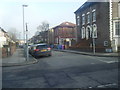
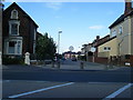
Living in L6 6WA means being part of a small, tightly knit residential cluster in England, home to 1926 residents. The area’s compact size fosters a sense of familiarity, though its character is shaped by a young demographic. With a median age of 22 and most residents aged 15–29, it reflects a community of students, recent graduates, and young professionals. The low home ownership rate of 22% suggests a rental-dominated market, with houses rather than flats forming the majority of accommodation. Proximity to retail, rail, and ferry networks adds practicality, while the absence of natural constraints like protected woodlands or AONB areas means development is unimpeded. However, the high crime risk score of 0—well above average—demands caution. Despite this, the area’s digital connectivity is near flawless, with broadband rated 99/100, ensuring reliable internet for work or study. For those prioritising convenience over tranquillity, L6 6WA offers a compact, accessible base with direct links to Liverpool’s transport hubs.
- Area Type
- Postcode
- Area Size
- Not available
- Population
- 1926
- Population Density
- 15059 people/km²
The property market in L6 6WA is characterised by low home ownership—only 22% of residents own their homes—suggesting a rental-dominated landscape. The area’s accommodation is primarily houses, not flats, which is unusual for a small postcode but may reflect its suburban or semi-rural setting. This mix of rental availability and house-based housing stock indicates a market more suited to tenants than long-term buyers. The limited population size of 1926 means the housing stock is modest, with few options for purchase within the area itself. Buyers may need to look beyond L6 6WA’s immediate boundaries to find more substantial property choices. The low home ownership rate also implies a transient population, which could affect the stability of the local market. For those seeking a home, the area’s proximity to transport links and amenities may outweigh its limited housing options, but the high crime risk score of 0 is a factor to consider.
House Prices in L6 6WA
No properties found in this postcode.
Energy Efficiency in L6 6WA
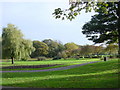
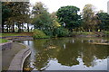
Residents of L6 6WA benefit from a range of nearby amenities, including five retail outlets such as Iceland Kensington, Lidl Fairfield, and Iceland Wavertree. These stores provide everyday shopping convenience, from groceries to household items. The area’s rail network, with stations like Edge Hill and Wavertree Technology Park, connects to Liverpool’s broader transport system, while ferry terminals at Liverpool Pier Head and Seacombe offer access to maritime travel. Though the area itself is small, its proximity to these amenities ensures a practical lifestyle. The mix of retail, transport, and ferry options supports both daily needs and occasional leisure activities. However, the lack of parks or green spaces is notable, given the absence of protected nature reserves or AONB coverage. For those prioritising convenience over natural scenery, the area’s accessibility to urban centres and services makes it a viable choice, though it may not appeal to those seeking more outdoor recreation.
Amenities
Schools
Residents of L6 6WA have access to two distinct schools: Kelso Independent School, a special school, and Harmonize Academy AP Free School, which falls under the ‘other’ category. The presence of a special school suggests the area may cater to students with specific educational needs, while the free school model indicates a focus on alternative or community-driven education. Families seeking a variety of school types will find these options useful, though the absence of Ofsted ratings means performance data is not available. The small population of 1926 means the schools likely serve a broader surrounding area, not just L6 6WA itself. For parents, the mix of school types offers flexibility but may require additional research to assess suitability. The proximity of these institutions to the area’s transport links—such as Edge Hill and Wavertree Technology Park railway stations—enhances their accessibility for students and staff.
| Rank | School | Type | Entry gender | Ages |
|---|
Explore more schools in this area
Go to Schools tabDemographics
L6 6WA’s population skews heavily towards young adults, with 22% of residents aged 15–29 and a median age of 22. This suggests a community dominated by students, graduates, or those entering the workforce. Only 22% of homes are owner-occupied, indicating a rental-heavy market, which may reflect the transient nature of the population. The accommodation is predominantly houses, not flats, which is uncommon in urban areas but aligns with the area’s small scale. The predominant ethnic group is White, though no data is provided on other demographics. The low home ownership rate and young age profile imply a dynamic but potentially unstable community. With just 1926 residents, the area lacks the density of larger towns, which may affect social cohesion and access to services. The absence of specific deprivation data means it is unclear how this impacts quality of life, but the high crime risk score of 0 suggests safety could be a concern for some.
Household Size
Accommodation Type
Tenure
Ethnic Group
Religion
Household Composition
Age
Household Deprivation
NS-SEC
Explore more demographic insights in this area
Go to Demographics tabPlanning
Planning Constraints
- Flood RiskPremium
- Ramsar Wetland SitesPremium
- Area of Outstanding Natural BeautyPremium
- Protected Nature ReservePremium
- Protected WoodlandPremium