Area Overview for L45 3QD
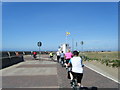
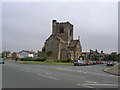
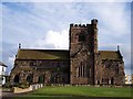
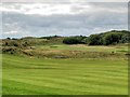
Photos of L45 3QD


Area Information
Living in L45 3QD offers a quiet, residential experience within the broader Wallasey area of Wirral, a historic suburb on the Wirral Peninsula opposite Liverpool. With a population of 1,410, this small postcode cluster is defined by its low-density housing and proximity to the River Mersey. The area’s roots trace back to early English settlements, with Wallasey once serving as a vital link for ferries and transport between Liverpool and the wider North West. Today, it remains a practical choice for those seeking a suburban lifestyle with easy access to nearby towns and amenities. The compact nature of L45 3QD means residents benefit from a close-knit community feel, though the area’s small size also means it is best suited for those prioritising convenience over sprawling landscapes. Its position on the Wirral Peninsula ensures it is well-connected to Liverpool via multiple ferry routes and rail services, making it a strategic location for commuters and families alike.
- Area Type
- Postcode
- Area Size
- Not available
- Population
- 1410
- Population Density
- 1530 people/km²
The property market in L45 3QD is characterised by high home ownership rates, with 80% of residents living in owner-occupied homes. This suggests a stable, long-term community with limited rental activity. The accommodation type is predominantly houses, indicating a focus on family-friendly, spacious properties rather than apartments or terraced housing. Given the area’s small size, the housing stock is likely limited to a few hundred properties, making it a niche market for buyers seeking suburban living. The high ownership rate implies strong local ties, which can be advantageous for buyers looking for a sense of permanence. However, the lack of significant rental demand may mean fewer opportunities for investors. For buyers, the area’s compact nature means properties are likely to be in close proximity to one another, with limited scope for expansion or redevelopment.
House Prices in L45 3QD
No properties found in this postcode.
Energy Efficiency in L45 3QD
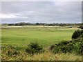
The lifestyle in L45 3QD is supported by a range of local amenities, including five retail outlets such as Co-op Wallasey, Lidl Wallasey, and Morrisons Daily, ensuring easy access to groceries and everyday essentials. The proximity to ferry terminals like Seacombe and Birkenhead provides opportunities for leisure travel or commuting across the Mersey. While the area’s small size limits large-scale leisure facilities, its connection to Wallasey’s broader infrastructure—such as Central Park, developed from historic estates—offers green space for recreation. The presence of multiple rail stations enhances accessibility to cultural and commercial hubs in Liverpool. Overall, the area balances practicality with convenience, catering to residents who value proximity to transport, shopping, and historical sites.
Amenities
Schools
| Rank | School | Type | Entry gender | Ages |
|---|
Explore more schools in this area
Go to Schools tabDemographics
The community in L45 3QD is predominantly composed of adults aged 30–64, with a median age of 47. This suggests a mature, stable population, likely with established careers and families. Home ownership is high, with 80% of residents living in owner-occupied properties, and the accommodation type is primarily houses rather than flats. The predominant ethnic group is White, reflecting the area’s historical demographics. With a population of 1,410, the community is small enough to foster familiarity but large enough to support local amenities. The age profile indicates a focus on middle-aged residents, which may influence local services and infrastructure needs. The absence of specific data on deprivation levels means the area’s quality of life can be inferred from its safety and connectivity, both of which are strong.
Household Size
Accommodation Type
Tenure
Ethnic Group
Religion
Household Composition
Age
Household Deprivation
NS-SEC
Explore more demographic insights in this area
Go to Demographics tabPlanning
Planning Constraints
- Flood RiskPremium
- Ramsar Wetland SitesPremium
- Area of Outstanding Natural BeautyPremium
- Protected Nature ReservePremium
- Protected WoodlandPremium