Area Overview for L40 9RZ
Photos of L40 9RZ
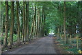
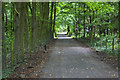
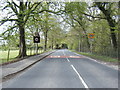
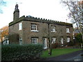
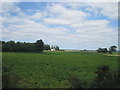
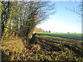
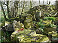

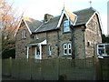
9 photos from this area
Area Information
Key information about the L40 9RZ including its size, population, and administrative classification.
- Area Type
- Postcode
- Area Size
- 57.9 hectares
- Population
- 2436
- Population Density
- 110 people/km²
House Prices in L40 9RZ
11
Properties
£387,083
Average Sold Price
£217,500
Lowest Price
£620,000
Highest Price
Showing 11 properties
| Address | Type | Beds | Baths | Last Sale Price | Last Sale Date | |
|---|---|---|---|---|---|---|
| Stable End, Scarisbrick Park, Scarisbrick, L40 9RZ | house | 4 | 3 | £620,000 | Feb 2023 | |
| Meadow End Cottage, 6 Scarisbrick Park, Scarisbrick, L40 9RZ | Semi-detached | 2 | 1 | £365,000 | Dec 2022 | |
| Holme Court, 5 Scarisbrick Park, Scarisbrick, L40 9RZ | Terraced | 4 | 2 | £340,000 | Jul 2019 | |
| Wood Cottage, 1 Scarisbrick Park, Scarisbrick, L40 9RZ | house | 2 | 1 | £217,500 | Aug 2018 | |
| The Old Coach House, 2 Scarisbrick Park, Scarisbrick, L40 9RZ | Semi-detached | 5 | 2 | £375,000 | Nov 2017 | |
| The Barn, Scarisbrick Park, Scarisbrick, L40 9RZ | Terraced | - | - | £405,000 | Dec 2007 | |
| The Old Mausoleum, 10 Scarisbrick Park, Scarisbrick, L40 9RZ | Terraced | 3 | 2 | - | - | |
| Home Farm Cottage, 4 Scarisbrick Park, Scarisbrick, L40 9RZ | Semi-detached | 3 | 1 | - | - | |
| Park Mews, Scarisbrick Park, Scarisbrick, L40 9RZ | Terraced | 3 | 2 | - | - | |
| Mallard Hey, 8 Scarisbrick Park, Scarisbrick, L40 9RZ | house | - | - | - | - |
Page 1 of 2
Energy Efficiency in L40 9RZ
Amenities
Schools
| Rank | School | Type | Entry gender | Ages |
|---|
Explore more schools in this area
Go to Schools tabDemographics
Household Size
Two person
most common
Accommodation Type
Houses
most common
Tenure
82
majority
Ethnic Group
White
most common
Religion
N/A
most common
Household Composition
N/A
most common
Age
47
median
Adults (30-64 years)
most common
Household Deprivation
N/A
with no deprivation
NS-SEC
34
in Lower managerial occupations
Explore more demographic insights in this area
Go to Demographics tabPlanning
Planning Constraints
- Flood RiskPremium
- Ramsar Wetland SitesPremium
- Area of Outstanding Natural BeautyPremium
- Protected Nature ReservePremium
- Protected WoodlandPremium