Area Overview for L40 8JZ
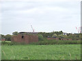
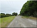
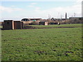
Photos of L40 8JZ


Area Information
Living in L40 8JZ means inhabiting a small, tightly knit residential cluster in England, where 1,775 people reside across 4.26 square kilometres. The area’s compact size fosters a close-knit community, with homes predominantly occupied by owners (78%) and a median age of 47 suggesting a mature demographic. Daily life here balances suburban tranquillity with practical access to nearby amenities. Residents benefit from proximity to railway stations, retail hubs, and a primary school with a good Ofsted rating. The area’s low flood risk and absence of environmental constraints like protected woodlands or AONB designations make it a stable, straightforward place to live. While the population density of 416 people per square kilometre is moderate, the focus on houses over flats reflects a traditional, family-oriented character. For those seeking a low-maintenance lifestyle with reliable infrastructure, L40 8JZ offers a blend of simplicity and accessibility.
- Area Type
- Postcode
- Area Size
- Not available
- Population
- 1775
- Population Density
- 416 people/km²
The property market in L40 8JZ is characterised by high home ownership (78%) and a focus on houses rather than flats or apartments. This suggests a market geared towards owner-occupiers seeking traditional, family-friendly housing rather than rental investors. The small area’s limited size means the housing stock is finite, potentially leading to competition among buyers. With no indication of recent development or new builds, property values may be influenced more by location factors than speculative growth. Buyers should consider the area’s proximity to amenities like rail stations and retail hubs, which enhance its appeal. However, the lack of planning constraints or environmental designations means the market is unlikely to face restrictions that could affect property availability or price trends.
House Prices in L40 8JZ
No properties found in this postcode.
Energy Efficiency in L40 8JZ
The lifestyle in L40 8JZ is shaped by its proximity to essential amenities. Residents can access Booths Burscough, Spar, and Tesco Ormskirk for shopping, ensuring daily needs are met without long trips. The five nearby rail stations, including New Lane and Burscough Junction, provide easy access to public transport, reducing reliance on cars for commuting. While the data does not mention parks or leisure facilities, the area’s small size suggests a compact, walkable environment. The presence of a primary school with a good Ofsted rating adds to the community’s appeal for families. Overall, the combination of retail, transport, and educational facilities creates a functional, convenient lifestyle tailored to those prioritising accessibility and practicality.
Amenities
Schools
The nearest school to L40 8JZ is Burscough Lordsgate Township Church of England Primary School, which serves the area’s younger residents. Rated ‘good’ by Ofsted, it provides a solid foundation for primary education. While no secondary schools are listed in the data, the presence of a well-regarded primary school is a key draw for families. The school’s location within practical reach of homes in L40 8JZ reduces the need for long commutes, supporting a balanced lifestyle. However, families requiring secondary education may need to look beyond the immediate area, as no further schools are detailed. This mix of school types reflects a community prioritising early education but reliant on nearby towns for higher stages.
| Rank | School | Type | Entry gender | Ages |
|---|
Explore more schools in this area
Go to Schools tabDemographics
The community in L40 8JZ is predominantly composed of adults aged 30–64, with a median age of 47. This suggests a mature population, likely with established careers and families. Home ownership is high at 78%, indicating a stable, long-term resident base rather than a transient rental market. The area’s accommodation is largely houses, which aligns with the demographic’s preference for private, spacious living. The predominant ethnic group is White, with no specific data on other groups provided. The absence of deprivation metrics in the data means no direct insight into economic challenges, but the high home ownership rate and age profile imply a generally secure financial environment. This demographic profile shapes a community focused on stability, with local amenities catering to older residents and families.
Household Size
Accommodation Type
Tenure
Ethnic Group
Religion
Household Composition
Age
Household Deprivation
NS-SEC
Explore more demographic insights in this area
Go to Demographics tabPlanning
Planning Constraints
- Flood RiskPremium
- Ramsar Wetland SitesPremium
- Area of Outstanding Natural BeautyPremium
- Protected Nature ReservePremium
- Protected WoodlandPremium