Area Overview for L40 7TG
Photos of L40 7TG

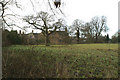
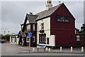
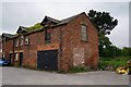

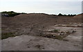


24 photos from this area
Area Information
Key information about the L40 7TG including its size, population, and administrative classification.
- Area Type
- Postcode
- Area Size
- 27.4 hectares
- Population
- 2150
- Population Density
- 687 people/km²
House Prices in L40 7TG
47
Properties
£146,243
Average Sold Price
£61,600
Lowest Price
£249,000
Highest Price
Showing 47 properties
| Address | Type | Beds | Baths | Last Sale Price | Last Sale Date | |
|---|---|---|---|---|---|---|
| 3 Mill Dam Lane, Burscough, L40 7TG | Semi-detached | 3 | - | £110,000 | Dec 2024 | |
| 77 Mill Dam Lane, Burscough, L40 7TG | Terraced | 3 | 1 | £220,000 | Jul 2023 | |
| 55 Mill Dam Lane, Burscough, L40 7TG | Semi-detached | 3 | 1 | £245,000 | May 2023 | |
| 87 Mill Dam Lane, Burscough, L40 7TG | Semi-detached | 3 | 2 | £180,000 | Mar 2023 | |
| 89 Mill Dam Lane, Burscough, L40 7TG | Semi-detached | 3 | 2 | £182,500 | Aug 2022 | |
| 51 Mill Dam Lane, Burscough, L40 7TG | house | - | - | £185,000 | Apr 2022 | |
| 85 Mill Dam Lane, Burscough, L40 7TG | Semi-detached | 3 | 1 | £150,000 | Nov 2021 | |
| 75 Mill Dam Lane, Burscough, L40 7TG | house | - | - | £139,000 | Aug 2021 | |
| 35 Mill Dam Lane, Burscough, L40 7TG | house | - | - | £142,000 | May 2021 | |
| 43 Mill Dam Lane, Burscough, L40 7TG | house | 2 | - | £149,000 | Oct 2019 |
Page 1 of 5
Energy Efficiency in L40 7TG
Amenities
Schools
| Rank | School | Type | Entry gender | Ages |
|---|
Explore more schools in this area
Go to Schools tabDemographics
Household Size
Two person
most common
Accommodation Type
Houses
most common
Tenure
87
majority
Ethnic Group
White
most common
Religion
N/A
most common
Household Composition
N/A
most common
Age
47
median
Adults (30-64 years)
most common
Household Deprivation
N/A
with no deprivation
NS-SEC
40
in Lower managerial occupations
Explore more demographic insights in this area
Go to Demographics tabPlanning
Planning Constraints
- Flood RiskPremium
- Ramsar Wetland SitesPremium
- Area of Outstanding Natural BeautyPremium
- Protected Nature ReservePremium
- Protected WoodlandPremium