Area Overview for L40 6HA
Photos of L40 6HA

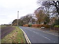
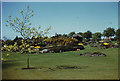
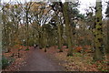
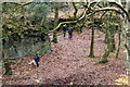
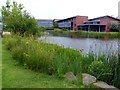
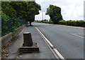
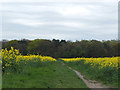
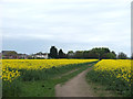
37 photos from this area
Area Information
Key information about the L40 6HA including its size, population, and administrative classification.
- Area Type
- Postcode
- Area Size
- 2.1 hectares
- Population
- 2614
- Population Density
- 373 people/km²
House Prices in L40 6HA
14
Properties
£836,429
Average Sold Price
£390,000
Lowest Price
£1,250,000
Highest Price
Showing 14 properties
| Address | Type | Beds | Baths | Last Sale Price | Last Sale Date | |
|---|---|---|---|---|---|---|
| Amberley, 91 Ruff Lane, Ormskirk, L40 6HA | house | - | - | £1,250,000 | Sep 2024 | |
| Thurlestone, 89 Ruff Lane, Ormskirk, L40 6HA | house | - | - | £1,150,000 | Mar 2023 | |
| Parklands, 87 Ruff Lane, Ormskirk, L40 6HA | house | - | - | £1,230,000 | Aug 2020 | |
| Erisort, 95 Ruff Lane, Ormskirk, L40 6HA | Bungalow | - | - | £390,000 | Sep 2016 | |
| Fircones, 93 Ruff Lane, Ormskirk, L40 6HA | Detached | 4 | - | £860,000 | Aug 2014 | |
| Genneka, 83 Ruff Lane, Ormskirk, L40 6HA | Bungalow | 4 | 2 | £440,000 | Dec 2009 | |
| The Coach House, 81 Ruff Lane, Ormskirk, L40 6HA | Detached | - | - | £535,000 | May 2007 | |
| White Lodge, 101 Ruff Lane, Ormskirk, L40 6HA | house | 3 | - | - | - | |
| Lighting Column Number 43, Whiteleys Lane, Lathom, Ormskirk, L40 6HA | commercial | - | - | - | - | |
| Glenluce, 97 Ruff Lane, Ormskirk, L40 6HA | Detached | - | - | - | - |
Page 1 of 2
Energy Efficiency in L40 6HA
Amenities
Schools
| Rank | School | Type | Entry gender | Ages |
|---|
Explore more schools in this area
Go to Schools tabDemographics
Household Size
Two person
most common
Accommodation Type
Houses
most common
Tenure
88
majority
Ethnic Group
White
most common
Religion
N/A
most common
Household Composition
N/A
most common
Age
22
median
Young Adults (15-29 years)
most common
Household Deprivation
N/A
with no deprivation
NS-SEC
20
in Lower managerial occupations
Explore more demographic insights in this area
Go to Demographics tabPlanning
Planning Constraints
- Flood RiskPremium
- Ramsar Wetland SitesPremium
- Area of Outstanding Natural BeautyPremium
- Protected Nature ReservePremium
- Protected WoodlandPremium