Area Overview for L40 4BG
Photos of L40 4BG
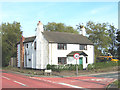
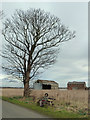
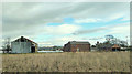

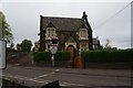
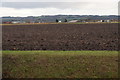
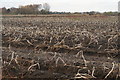
51 photos from this area
Area Information
Key information about the L40 4BG including its size, population, and administrative classification.
- Area Type
- Postcode
- Area Size
- 67.9 hectares
- Population
- 2025
- Population Density
- 97 people/km²
House Prices in L40 4BG
17
Properties
£286,875
Average Sold Price
£140,000
Lowest Price
£460,000
Highest Price
Showing 17 properties
| Address | Type | Beds | Baths | Last Sale Price | Last Sale Date | |
|---|---|---|---|---|---|---|
| Beacon View, Hoscar Moss Road, Lathom, L40 4BG | Semi-detached | 3 | 1 | £360,000 | Nov 2023 | |
| Arbor Del, Hoscar Moss Road, Lathom, L40 4BG | Detached | 2 | 1 | £460,000 | Jan 2023 | |
| Acer Cottage, Hoscar Moss Road, Lathom, L40 4BG | Bungalow | - | - | £265,000 | Oct 2015 | |
| Mission House, Hoscar Moss Road, Lathom, L40 4BG | Semi-detached | - | - | £300,000 | Mar 2014 | |
| Beechcroft, Hoscar Moss Road, Lathom, L40 4BG | Bungalow | - | - | £210,000 | Jan 2014 | |
| Chapel House, Hoscar Moss Road, Lathom, L40 4BG | Retail | 2 | 1 | £350,000 | May 2008 | |
| Station House, Hoscar Moss Road, Lathom, L40 4BG | Detached | - | - | £140,000 | May 2003 | |
| Clifton House, Hoscar Moss Road, Lathom, L40 4BG | Detached | - | - | £210,000 | Oct 2001 | |
| Hoscar Hall Farm, Hoscar Moss Road, Lathom, L40 4BG | office_workshop | 5 | 2 | - | - | |
| Hoscar Cottage, Hoscar Moss Road, Lathom, L40 4BG | Land | 5 | - | - | - |
Page 1 of 2
Energy Efficiency in L40 4BG
Amenities
Schools
| Rank | School | Type | Entry gender | Ages |
|---|
Explore more schools in this area
Go to Schools tabDemographics
Household Size
Two person
most common
Accommodation Type
Houses
most common
Tenure
87
majority
Ethnic Group
White
most common
Religion
N/A
most common
Household Composition
N/A
most common
Age
47
median
Adults (30-64 years)
most common
Household Deprivation
N/A
with no deprivation
NS-SEC
45
in Lower managerial occupations
Explore more demographic insights in this area
Go to Demographics tabPlanning
Planning Constraints
- Flood RiskPremium
- Ramsar Wetland SitesPremium
- Area of Outstanding Natural BeautyPremium
- Protected Nature ReservePremium
- Protected WoodlandPremium