Area Overview for L40 3SY
Photos of L40 3SY

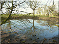
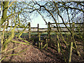
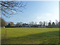
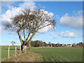
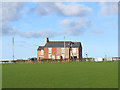
19 photos from this area
Area Information
Key information about the L40 3SY including its size, population, and administrative classification.
- Area Type
- Postcode
- Area Size
- 50.6 hectares
- Population
- 1563
- Population Density
- 208 people/km²
House Prices in L40 3SY
23
Properties
£696,000
Average Sold Price
£375,000
Lowest Price
£1,180,000
Highest Price
Showing 23 properties
| Address | Type | Beds | Baths | Last Sale Price | Last Sale Date | |
|---|---|---|---|---|---|---|
| The Paddocks, Back Lane, Mawdesley, L40 3SY | Detached | - | - | £375,000 | Apr 2024 | |
| Horseshoe Cottage, Back Lane, Mawdesley, L40 3SY | Semi-detached | 3 | 1 | £617,500 | Nov 2023 | |
| Cedar Cottage, Back Lane, Mawdesley, L40 3SY | Detached | - | - | £457,500 | Jun 2008 | |
| South View, Back Lane, Mawdesley, L40 3SY | house | - | - | £850,000 | Apr 2008 | |
| BEECH HOUSE, BACK LANE, Mawdesley, L40 3SY | Detached | 5 | - | £1,180,000 | Mar 2005 | |
| Gorsey Lane Stables, Gorsey Lane, Mawdesley, L40 3SY | Equestrian | - | - | - | - | |
| Anise, Unit 3, Cedar Farm Gallery, Back Lane, Mawdesley, L40 3SY | house | - | - | - | - | |
| Secrett Artwork, Unit 5 Art At Cedar Farm, Cedar House Farm, Back Lane, Mawdesley, L40 3SY | shop | - | - | - | - | |
| Wickerfish, Unit 2 The Pig Barn, Cedar House Farm, Back Lane, Mawdesley, L40 3SY | Office | - | - | - | - | |
| Farmers Market, Cedar Farm Gallery, Back Lane, Mawdesley, L40 3SY | Retail | - | - | - | - |
Page 1 of 3
Energy Efficiency in L40 3SY
Amenities
Schools
| Rank | School | Type | Entry gender | Ages |
|---|
Explore more schools in this area
Go to Schools tabDemographics
Household Size
Two person
most common
Accommodation Type
Houses
most common
Tenure
85
majority
Ethnic Group
White
most common
Religion
N/A
most common
Household Composition
N/A
most common
Age
47
median
Adults (30-64 years)
most common
Household Deprivation
N/A
with no deprivation
NS-SEC
45
in Lower managerial occupations
Explore more demographic insights in this area
Go to Demographics tabPlanning
Planning Constraints
- Flood RiskPremium
- Ramsar Wetland SitesPremium
- Area of Outstanding Natural BeautyPremium
- Protected Nature ReservePremium
- Protected WoodlandPremium