Area Overview for L40 0SB
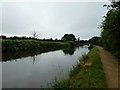
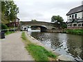
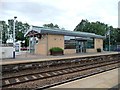
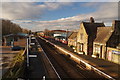
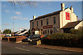
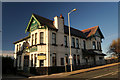
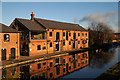
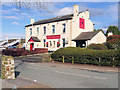
Photos of L40 0SB
Area Information
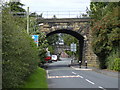
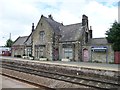
Living in L40 0SB means being part of a small, tightly knit residential cluster in England. With a population of 1,649 spread across 470 people per square kilometre, the area feels compact yet functional. The median age of 47 suggests a community of established residents, many of whom are likely to have lived in the area for years. Daily life here balances quiet living with practical access to amenities. The presence of multiple rail stations, including Burscough Junction and New Lane, ensures easy travel to nearby towns. Nearby shops, from Spar to Tesco Ormskirk, cater to everyday needs. For families, the mix of primary and academy schools offers varied educational options. While the area lacks natural constraints like protected woodlands or AONBs, its low flood risk and below-average crime rates make it a stable, secure place to live. L40 0SB is ideal for those seeking a peaceful, well-connected small community with a strong sense of local identity.
- Area Type
- Postcode
- Area Size
- Not available
- Population
- 1649
- Population Density
- 470 people/km²
The property market in L40 0SB is characterised by a high rate of home ownership—73% of residents own their homes. This suggests a stable, long-term market with limited rental activity, making it more of an owner-occupied area than a rental hub. The predominant accommodation type is houses, which are likely to be family homes or larger properties suited to the area’s mature demographic. Given the small size of the postcode and its focus on houses, the housing stock is limited, meaning buyers may need to consider nearby areas for more options. The high home ownership rate also indicates strong community ties, with residents less likely to move frequently. For buyers, this means a market that prioritises security and permanence, though competition for existing properties could be fierce due to the area’s limited size.
House Prices in L40 0SB
No properties found in this postcode.
Energy Efficiency in L40 0SB
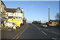
The lifestyle in L40 0SB is shaped by its accessible amenities and community-focused infrastructure. Within practical reach are five retail venues, including Spar and Tesco Ormskirk, offering a range of shopping and convenience options. The rail stations, such as Burscough Junction and New Lane, provide straightforward links to nearby towns, enhancing mobility for both daily commutes and weekend excursions. While the area lacks detailed data on parks or leisure facilities, the presence of multiple retail and transport hubs suggests a practical, service-oriented lifestyle. The mix of shops and rail access contributes to a self-contained environment, where residents can meet daily needs without venturing far. This balance of convenience and connectivity supports a lifestyle that prioritises ease of access and community engagement.
Amenities
Schools
Residents of L40 0SB have access to a range of educational institutions. Burscough Bridge Methodist School is a primary school with a good Ofsted rating, offering a solid foundation for younger children. Burscough Priory Science College is also a primary school, though its Ofsted rating is not specified. For secondary education, Burscough Priory Academy is an academy with a good rating, providing a structured, possibly more specialised curriculum. The mix of primary and academy schools allows families to choose between traditional schooling and the potentially more focused approach of academy settings. These institutions collectively ensure a variety of educational pathways, supporting both academic and personal development. The proximity of these schools to the area makes them a key consideration for families prioritising quality education.
| Rank | School | Type | Entry gender | Ages |
|---|
Explore more schools in this area
Go to Schools tabDemographics
The community in L40 0SB is predominantly composed of adults aged 30–64, with a median age of 47. This suggests a mature population, likely with long-term ties to the area. Home ownership is high, at 73%, indicating a stable housing market and a focus on long-term residency. The accommodation type is primarily houses, which aligns with the demographic profile of older, established households. The predominant ethnic group is White, reflecting a homogenous community. While no data on deprivation is provided, the high home ownership rate and low crime risk imply a relatively affluent and secure environment. The population density of 470 people per square kilometre means the area is neither overcrowded nor sparse, offering a balanced living experience. This demographic profile suggests a community that values stability, familiarity, and proximity to essential services.
Household Size
Accommodation Type
Tenure
Ethnic Group
Religion
Household Composition
Age
Household Deprivation
NS-SEC
Explore more demographic insights in this area
Go to Demographics tabPlanning
Planning Constraints
- Flood RiskPremium
- Ramsar Wetland SitesPremium
- Area of Outstanding Natural BeautyPremium
- Protected Nature ReservePremium
- Protected WoodlandPremium