Area Overview for L4 5SE
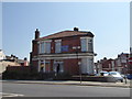
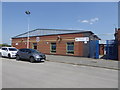
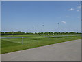
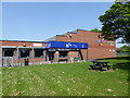
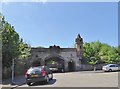
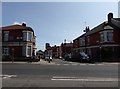
Photos of L4 5SE


Area Information
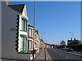
Living in L4 5SE offers a compact, residential environment with a population of 1,396, centred around a small cluster of homes. This area is defined by its proximity to essential services, including multiple schools, rail networks, and ferry terminals, making it practical for daily commuting and leisure. The community is predominantly composed of adults aged 30–64, with a median age of 47, suggesting a mature, stable population. While the area lacks large-scale amenities, its accessibility to Liverpool’s transport hubs and retail options like Morrisons and Farmfoods ensures convenience. The broadband score of 100 reflects excellent digital connectivity, supporting remote work and online activities. However, the crime risk is notably high, with a safety score of 20, requiring residents to consider security measures. For those prioritising proximity to schools and transport, L4 5SE provides a functional base, though its small size means limited housing options and a tight-knit community feel.
- Area Type
- Postcode
- Area Size
- Not available
- Population
- 1396
- Population Density
- 9294 people/km²
The property market in L4 5SE is characterised by a low home ownership rate of 31%, suggesting that the area is more rental-oriented than owner-occupied. The accommodation type is predominantly houses, which implies a lack of high-rise or apartment-style living. Given the small population and limited housing stock, the market is likely competitive for buyers, with limited scope for expansion. The area’s proximity to transport links, including rail and ferry services, may attract commuters seeking affordable housing near Liverpool’s core. However, the low home ownership rate and small size mean that properties are likely to be in high demand, with limited availability for those seeking long-term ownership. Buyers should consider the practicality of rental options and the potential for limited property choice in this confined postcode.
House Prices in L4 5SE
No properties found in this postcode.
Energy Efficiency in L4 5SE
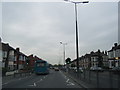
The lifestyle in L4 5SE is shaped by its proximity to practical amenities, including retail outlets like Heron Walton, Morrisons Daily Liverpool, and Farmfoods Kirkdale. These shops provide access to groceries, household goods, and everyday necessities without requiring long journeys. The area’s rail and ferry connections enhance its appeal, offering easy access to Liverpool’s cultural and commercial hubs. While there are no named parks or leisure facilities in the data, the presence of multiple transport options and retail venues suggests a focus on convenience over expansive recreational spaces. Residents benefit from a compact, service-oriented environment, though the lack of detailed information on parks or entertainment options may limit opportunities for outdoor activities or social gatherings.
Amenities
Schools
Residents of L4 5SE have access to three primary schools: Gwladys Street Primary and Nursery School, Gwladys Street County Junior School, and Gwladys Street County Infant School. The nursery and infant school hold an Ofsted rating of ‘good’, indicating a solid foundation for early education. While the junior school’s rating is not specified, the presence of multiple schools catering to different age groups suggests a comprehensive educational offering for families. This cluster of schools supports parents seeking primary education within walking distance, reducing the need for long commutes. The concentration of schools also implies a focus on family-friendly infrastructure, though the absence of secondary schools means students may need to travel for further education.
| Rank | School | Type | Entry gender | Ages |
|---|
Explore more schools in this area
Go to Schools tabDemographics
The community in L4 5SE is predominantly composed of adults aged 30–64, with a median age of 47. This suggests a mature population, likely with established careers and family structures. Home ownership stands at 31%, indicating that the majority of residents rent their properties. The accommodation type is primarily houses, which contrasts with areas dominated by flats or apartments. The predominant ethnic group is White, reflecting a homogenous demographic profile. With a population of 1,396, the area is small enough to foster a close-knit community but limited in scale to offer diverse social or cultural experiences. The low home ownership rate may impact long-term stability for residents, though the presence of multiple schools and transport links suggests a focus on practical living over expansive amenities.
Household Size
Accommodation Type
Tenure
Ethnic Group
Religion
Household Composition
Age
Household Deprivation
NS-SEC
Explore more demographic insights in this area
Go to Demographics tabPlanning
Planning Constraints
- Flood RiskPremium
- Ramsar Wetland SitesPremium
- Area of Outstanding Natural BeautyPremium
- Protected Nature ReservePremium
- Protected WoodlandPremium