Area Overview for L4 2SL
Photos of L4 2SL
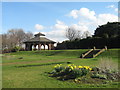
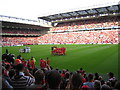
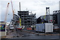
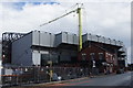
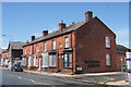
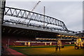
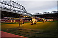

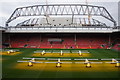
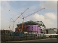
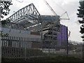
100 photos from this area
Area Information
Key information about the L4 2SL including its size, population, and administrative classification.
- Area Type
- Postcode
- Area Size
- 16.2 hectares
- Population
- 1474
- Population Density
- 2162 people/km²
House Prices in L4 2SL
8
Properties
£229,000
Average Sold Price
£229,000
Lowest Price
£229,000
Highest Price
Showing 8 properties
| Address | Type | Beds | Baths | Last Sale Price | Last Sale Date | |
|---|---|---|---|---|---|---|
| 242 Priory Road, Liverpool, L4 2SL | Semi-detached | - | - | £229,000 | Nov 2006 | |
| 240 Priory Road, Liverpool, L4 2SL | house | - | - | - | - | |
| 236 Priory Road, Liverpool, L4 2SL | Detached | - | - | - | - | |
| Vernon Sangster Sports Centre, Priory Road, Liverpool, L4 2SL | Leisure | - | - | - | - | |
| Anfield Mot Services, 232 Priory Road, Liverpool, L4 2SL | office_workshop | - | - | - | - | |
| Boathouse, Stanley Park, Walton Lane, Liverpool, L4 2SL | Leisure | - | - | - | - | |
| Spar, 232 Priory Road, Liverpool, L4 2SL | shop | - | - | - | - | |
| Priority Garage And Filling Station, 232 Priory Road, Liverpool, L4 2SL | retail_financial | - | - | - | - |
Energy Efficiency in L4 2SL
Amenities
Schools
| Rank | School | Type | Entry gender | Ages |
|---|
Explore more schools in this area
Go to Schools tabDemographics
Household Size
One person
most common
Accommodation Type
Houses
most common
Tenure
49
majority
Ethnic Group
White
most common
Religion
N/A
most common
Household Composition
N/A
most common
Age
47
median
Adults (30-64 years)
most common
Household Deprivation
N/A
with no deprivation
NS-SEC
22
in Lower managerial occupations
Explore more demographic insights in this area
Go to Demographics tabPlanning
Planning Constraints
- Flood RiskPremium
- Ramsar Wetland SitesPremium
- Area of Outstanding Natural BeautyPremium
- Protected Nature ReservePremium
- Protected WoodlandPremium