Area Overview for L4 2RU
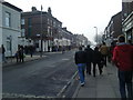
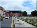
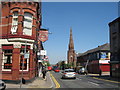
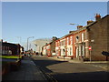
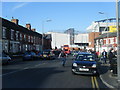
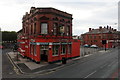
Photos of L4 2RU


Area Information
Living in L4 2RU means being part of a small, tightly knit residential cluster in England. With a population of 1,667, this area is compact yet conveniently positioned near essential services and transport links. The community here is primarily composed of adults aged 30–64, reflecting a mature demographic profile. Daily life is shaped by proximity to schools, rail networks, and ferry terminals, which provide both local convenience and regional connectivity. The area’s broadband score of 99 ensures near-flawless internet access, ideal for remote work or online learning, while mobile coverage of 85 offers reliable connectivity for most needs. Although the area is small, it is served by multiple rail stations and ferry ports, linking residents to Liverpool’s city centre, surrounding towns, and even offshore destinations. This balance of accessibility and residential tranquillity makes L4 2RU a practical choice for those prioritising ease of movement and essential infrastructure.
- Area Type
- Postcode
- Area Size
- Not available
- Population
- 1667
- Population Density
- 10888 people/km²
The property market in L4 2RU is defined by a low home ownership rate of 28%, suggesting a higher proportion of rental properties. The accommodation type is predominantly houses, which is unusual for areas with higher population density. This mix implies a focus on single-family homes rather than apartments or terraced housing. Given the area’s small size, the housing stock is limited, meaning buyers may need to look beyond immediate surroundings for options. The low home ownership rate could indicate a transient population or a market where long-term investment is less common. For those seeking to purchase, the availability of houses may appeal to families or individuals prioritising space, though the limited size of the area means competition for properties is likely. Proximity to transport links and schools adds value, but buyers should consider the broader regional market for more choices.
House Prices in L4 2RU
No properties found in this postcode.
Energy Efficiency in L4 2RU
Lifestyle in L4 2RU is shaped by its proximity to a range of amenities. Retail options include Morrisons Daily, Spar, and Farmfoods Anfield, offering everyday shopping convenience. Rail stations such as Kirkdale and Sandhills provide access to public transport, while ferry terminals like Liverpool Pier Head connect residents to nearby cities and islands. These transport links enable easy commuting to Liverpool’s city centre or further afield. The presence of multiple retail outlets and transport hubs contributes to a practical, accessible daily life. While the area lacks large leisure facilities, its small size ensures amenities are within walking or short driving distance. The combination of shops, transport, and regional connectivity makes L4 2RU suitable for those prioritising convenience and mobility over expansive recreational spaces.
Amenities
Schools
Residents of L4 2RU have access to three schools within practical reach. All Saints Catholic Infant and Nursery School provides early years and primary education, while All Saints’ Catholic Voluntary Aided Primary School is rated outstanding by Ofsted. This latter school offers a strong foundation for children aged 3–11, reflecting high standards in local education. The Red Balloon Learner Centre – Merseyside specialises in supporting learners with additional needs, offering a tailored approach to education. The combination of mainstream and special needs provision ensures families can access both general and specialist schooling. For parents, the presence of an outstanding primary school is a significant advantage, though the absence of secondary schools may require commuting. The variety of educational options caters to diverse family needs, from early education to specialist support.
| Rank | School | Type | Entry gender | Ages |
|---|
Explore more schools in this area
Go to Schools tabDemographics
The population of L4 2RU is predominantly adults aged 30–64, with a median age of 47. This suggests a community of middle-aged residents, likely focused on stability and long-term living. Home ownership stands at 28%, indicating a majority of properties are rented rather than owned, which may reflect the area’s character as a rental-focused cluster. The accommodation type is primarily houses, contrasting with higher-density housing in larger urban areas. The predominant ethnic group is White, though specific data on diversity or deprivation is not available. The low home ownership rate may influence the local economy, with fewer long-term residents investing in property. For families, the presence of schools and transport options aligns with the needs of this age group, offering practicality for both work and education.
Household Size
Accommodation Type
Tenure
Ethnic Group
Religion
Household Composition
Age
Household Deprivation
NS-SEC
Explore more demographic insights in this area
Go to Demographics tabPlanning
Planning Constraints
- Flood RiskPremium
- Ramsar Wetland SitesPremium
- Area of Outstanding Natural BeautyPremium
- Protected Nature ReservePremium
- Protected WoodlandPremium