Area Overview for L4 0SF
Photos of L4 0SF
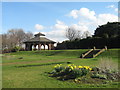
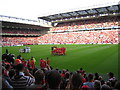
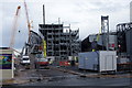
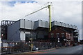
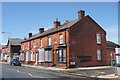


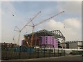
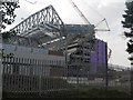
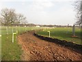
100 photos from this area
Area Information
Key information about the L4 0SF including its size, population, and administrative classification.
- Area Type
- Postcode
- Area Size
- 1.6 hectares
- Population
- 1304
- Population Density
- 12302 people/km²
House Prices in L4 0SF
82
Properties
£48,600
Average Sold Price
£10,000
Lowest Price
£135,000
Highest Price
Showing 82 properties
| Address | Type | Beds | Baths | Last Sale Price | Last Sale Date | |
|---|---|---|---|---|---|---|
| 48 Rockfield Road, Liverpool, L4 0SF | house | - | - | £44,250 | Jul 2025 | |
| 72 Rockfield Road, Liverpool, L4 0SF | house | - | - | £130,000 | Dec 2021 | |
| 8 Rockfield Road, Liverpool, L4 0SF | house | - | - | £135,000 | Jul 2021 | |
| 40 Rockfield Road, Liverpool, L4 0SF | house | - | - | £115,000 | May 2021 | |
| 38 Rockfield Road, Liverpool, L4 0SF | Terraced | 4 | 1 | £115,000 | Jun 2020 | |
| 92 Rockfield Road, Liverpool, L4 0SF | Terraced | - | - | £84,000 | Sep 2013 | |
| 50 Rockfield Road, Liverpool, L4 0SF | house | - | - | £28,000 | Aug 2012 | |
| 84 Rockfield Road, Liverpool, L4 0SF | Detached | - | - | £120,000 | Aug 2010 | |
| 18 Rockfield Road, Liverpool, L4 0SF | house | - | - | £29,500 | Jun 2010 | |
| 34 Rockfield Road, Liverpool, L4 0SF | house | - | - | £35,000 | Apr 2008 |
Page 1 of 9
Energy Efficiency in L4 0SF
Amenities
Schools
| Rank | School | Type | Entry gender | Ages |
|---|
Explore more schools in this area
Go to Schools tabDemographics
Household Size
One person
most common
Accommodation Type
Houses
most common
Tenure
24
majority
Ethnic Group
White
most common
Religion
N/A
most common
Household Composition
N/A
most common
Age
47
median
Adults (30-64 years)
most common
Household Deprivation
N/A
with no deprivation
NS-SEC
12
in Lower managerial occupations
Explore more demographic insights in this area
Go to Demographics tabPlanning
Planning Constraints
- Flood RiskPremium
- Ramsar Wetland SitesPremium
- Area of Outstanding Natural BeautyPremium
- Protected Nature ReservePremium
- Protected WoodlandPremium