Area Overview for L39 8SA
Photos of L39 8SA
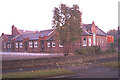
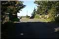
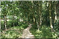
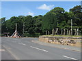
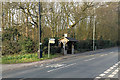
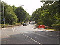
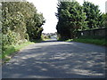
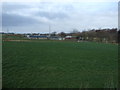
20 photos from this area
Area Information
Key information about the L39 8SA including its size, population, and administrative classification.
- Area Type
- Postcode
- Area Size
- 25.5 hectares
- Population
- 2185
- Population Density
- 78 people/km²
House Prices in L39 8SA
18
Properties
£269,300
Average Sold Price
£71,000
Lowest Price
£515,000
Highest Price
Showing 18 properties
| Address | Type | Beds | Baths | Last Sale Price | Last Sale Date | |
|---|---|---|---|---|---|---|
| 84 Carr Moss Lane, Halsall, L39 8SA | house | - | - | £400,000 | Jan 2023 | |
| 88 Carr Moss Lane, Halsall, L39 8SA | Semi-detached | 3 | 1 | £340,000 | May 2021 | |
| 96 Carr Moss Lane, Halsall, L39 8SA | Detached | 5 | 4 | £515,000 | Apr 2020 | |
| 28 Carr Moss Lane, Halsall, L39 8SA | house | - | - | £215,000 | Sep 2019 | |
| 82 Carr Moss Lane, Halsall, L39 8SA | Detached | 5 | 4 | £270,000 | Dec 2017 | |
| Greenacres, 76 Carr Moss Lane, Halsall, L39 8SA | house | - | - | £341,000 | Aug 2017 | |
| Moss View House, 78 Carr Moss Lane, Halsall, L39 8SA | Semi-detached | 5 | - | £354,500 | Mar 2017 | |
| 90 Carr Moss Lane, Halsall, L39 8SA | Detached | - | - | £101,500 | Jul 1997 | |
| 94 Carr Moss Lane, Halsall, L39 8SA | Semi-detached | - | - | £71,000 | Jul 1997 | |
| 86 Carr Moss Lane, Halsall, L39 8SA | Semi-detached | - | - | £85,000 | Aug 1995 |
Page 1 of 2
Energy Efficiency in L39 8SA
Amenities
Schools
| Rank | School | Type | Entry gender | Ages |
|---|
Explore more schools in this area
Go to Schools tabDemographics
Household Size
Two person
most common
Accommodation Type
Houses
most common
Tenure
84
majority
Ethnic Group
White
most common
Religion
N/A
most common
Household Composition
N/A
most common
Age
47
median
Adults (30-64 years)
most common
Household Deprivation
N/A
with no deprivation
NS-SEC
36
in Lower managerial occupations
Explore more demographic insights in this area
Go to Demographics tabPlanning
Planning Constraints
- Flood RiskPremium
- Ramsar Wetland SitesPremium
- Area of Outstanding Natural BeautyPremium
- Protected Nature ReservePremium
- Protected WoodlandPremium