Area Overview for L39 5DA
Photos of L39 5DA
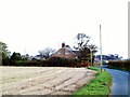
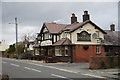
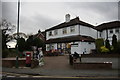
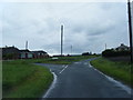
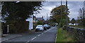

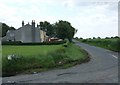


12 photos from this area
Area Information
Key information about the L39 5DA including its size, population, and administrative classification.
- Area Type
- Postcode
- Area Size
- 3.2 hectares
- Population
- 1259
- Population Density
- 1065 people/km²
House Prices in L39 5DA
37
Properties
£161,193
Average Sold Price
£44,500
Lowest Price
£280,000
Highest Price
Showing 37 properties
| Address | Type | Beds | Baths | Last Sale Price | Last Sale Date | |
|---|---|---|---|---|---|---|
| 158 Long Lane, Aughton, L39 5DA | Semi-detached | 2 | 1 | £235,000 | Apr 2024 | |
| 122 Long Lane, Aughton, L39 5DA | Semi-detached | 3 | - | £250,000 | Apr 2023 | |
| 172 Long Lane, Aughton, L39 5DA | Bungalow | - | - | £175,000 | Jun 2020 | |
| 136 Long Lane, Aughton, L39 5DA | Bungalow | 2 | 1 | £182,000 | Dec 2019 | |
| 112 Long Lane, Aughton, L39 5DA | Semi-detached | 2 | 2 | £280,000 | Sep 2019 | |
| 110 Long Lane, Aughton, L39 5DA | Bungalow | - | - | £187,950 | Apr 2019 | |
| 124 Long Lane, Aughton, L39 5DA | Bungalow | - | - | £260,000 | Dec 2017 | |
| 164 Long Lane, Aughton, L39 5DA | Semi-detached | 2 | - | £175,000 | Oct 2017 | |
| 152 Long Lane, Aughton, L39 5DA | Semi-detached | 2 | - | £210,000 | Sep 2016 | |
| 174 Long Lane, Aughton, L39 5DA | Semi-detached | 2 | - | £160,000 | Oct 2015 |
Page 1 of 4
Energy Efficiency in L39 5DA
Amenities
Schools
| Rank | School | Type | Entry gender | Ages |
|---|
Explore more schools in this area
Go to Schools tabDemographics
Household Size
Two person
most common
Accommodation Type
Houses
most common
Tenure
96
majority
Ethnic Group
White
most common
Religion
N/A
most common
Household Composition
N/A
most common
Age
47
median
Adults (30-64 years)
most common
Household Deprivation
N/A
with no deprivation
NS-SEC
53
in Lower managerial occupations
Explore more demographic insights in this area
Go to Demographics tabPlanning
Planning Constraints
- Flood RiskPremium
- Ramsar Wetland SitesPremium
- Area of Outstanding Natural BeautyPremium
- Protected Nature ReservePremium
- Protected WoodlandPremium