Area Overview for L39 4YH
Photos of L39 4YH
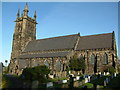
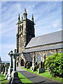
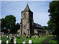
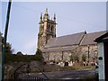
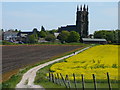
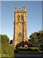
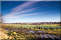
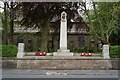

39 photos from this area
Area Information
Key information about the L39 4YH including its size, population, and administrative classification.
- Area Type
- Postcode
- Area Size
- 9824 m²
- Population
- 1545
- Population Density
- 3460 people/km²
House Prices in L39 4YH
26
Properties
£179,737
Average Sold Price
£38,215
Lowest Price
£410,000
Highest Price
Showing 26 properties
| Address | Type | Beds | Baths | Last Sale Price | Last Sale Date | |
|---|---|---|---|---|---|---|
| 16 Parkfield Close, Ormskirk, L39 4YH | house | - | - | £407,500 | Dec 2025 | |
| 22 Parkfield Close, Ormskirk, L39 4YH | house | - | - | £410,000 | Nov 2022 | |
| 11 Parkfield Close, Ormskirk, L39 4YH | house | - | - | £95,000 | May 2021 | |
| 27 Parkfield Close, Ormskirk, L39 4YH | house | - | - | £178,000 | Nov 2019 | |
| 9 Parkfield Close, Ormskirk, L39 4YH | house | 3 | - | £94,000 | Sep 2018 | |
| 20 Parkfield Close, Ormskirk, L39 4YH | Detached | 3 | 3 | £270,000 | Aug 2018 | |
| 21 Parkfield Close, Ormskirk, L39 4YH | house | - | - | £185,000 | Sep 2017 | |
| 6 Parkfield Close, Ormskirk, L39 4YH | Bungalow | - | - | £250,000 | Dec 2016 | |
| 13 Parkfield Close, Ormskirk, L39 4YH | house | - | - | £90,000 | Oct 2016 | |
| 10 Parkfield Close, Ormskirk, L39 4YH | house | 3 | 3 | £170,000 | Jul 2016 |
Page 1 of 3
Energy Efficiency in L39 4YH
Amenities
Schools
| Rank | School | Type | Entry gender | Ages |
|---|
Explore more schools in this area
Go to Schools tabDemographics
Household Size
Two person
most common
Accommodation Type
Houses
most common
Tenure
93
majority
Ethnic Group
White
most common
Religion
N/A
most common
Household Composition
N/A
most common
Age
47
median
Adults (30-64 years)
most common
Household Deprivation
N/A
with no deprivation
NS-SEC
46
in Lower managerial occupations
Explore more demographic insights in this area
Go to Demographics tabPlanning
Planning Constraints
- Flood RiskPremium
- Ramsar Wetland SitesPremium
- Area of Outstanding Natural BeautyPremium
- Protected Nature ReservePremium
- Protected WoodlandPremium