Area Overview for L39 4TR
Photos of L39 4TR
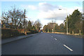
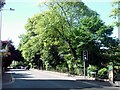
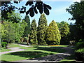
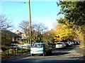
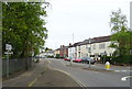
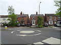
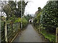
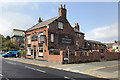
28 photos from this area
Area Information
Key information about the L39 4TR including its size, population, and administrative classification.
- Area Type
- Postcode
- Area Size
- 1.1 hectares
- Population
- 1687
- Population Density
- 3038 people/km²
House Prices in L39 4TR
15
Properties
£157,050
Average Sold Price
£58,000
Lowest Price
£395,000
Highest Price
Showing 15 properties
| Address | Type | Beds | Baths | Last Sale Price | Last Sale Date | |
|---|---|---|---|---|---|---|
| 5 Railway Path, Ormskirk, L39 4TR | house | - | - | £160,000 | Jun 2022 | |
| 9 Railway Path, Ormskirk, L39 4TR | house | - | - | £115,000 | Feb 2022 | |
| 7 Railway Path, Ormskirk, L39 4TR | house | 2 | - | £120,000 | Jan 2022 | |
| 4 Railway Path, Ormskirk, L39 4TR | house | - | - | £170,000 | Aug 2021 | |
| 2 Railway Path, Ormskirk, L39 4TR | Terraced | 2 | - | £141,500 | Nov 2014 | |
| Grey Mist Lodge, Railway Path, Ormskirk, L39 4TR | Detached | 4 | - | £395,000 | Aug 2014 | |
| 17 Railway Path, Ormskirk, L39 4TR | Terraced | 2 | 1 | £134,000 | Jan 2008 | |
| 19 Railway Path, Ormskirk, L39 4TR | Detached | - | - | £119,950 | Jun 2005 | |
| 15 Railway Path, Ormskirk, L39 4TR | house | 2 | - | £58,000 | Mar 2002 | |
| Poppy Brook House, 1 Railway Path, Ormskirk, L39 4TR | Semi-detached | 3 | - | - | - |
Page 1 of 2
Energy Efficiency in L39 4TR
Amenities
Schools
| Rank | School | Type | Entry gender | Ages |
|---|
Explore more schools in this area
Go to Schools tabDemographics
Household Size
One person
most common
Accommodation Type
Houses
most common
Tenure
57
majority
Ethnic Group
White
most common
Religion
N/A
most common
Household Composition
N/A
most common
Age
47
median
Adults (30-64 years)
most common
Household Deprivation
N/A
with no deprivation
NS-SEC
28
in Lower managerial occupations
Explore more demographic insights in this area
Go to Demographics tabPlanning
Planning Constraints
- Flood RiskPremium
- Ramsar Wetland SitesPremium
- Area of Outstanding Natural BeautyPremium
- Protected Nature ReservePremium
- Protected WoodlandPremium