Area Overview for L39 4QS
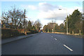
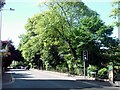
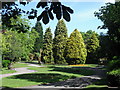
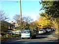
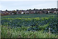
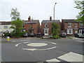
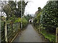
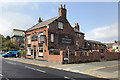
Photos of L39 4QS

Area Information
Living in L39 4QS means being part of a tightly knit residential cluster in England, where 2,690 residents share a densely populated area of 2,627 people per square kilometre. This small postcode area is defined by its compact nature, with homes predominantly in the form of houses rather than flats. The community is young, with a median age of 22 and the majority of residents aged 15–29. This demographic suggests a dynamic, possibly student-influenced environment, given the proximity to Edge Hill University. Daily life here is shaped by proximity to rail networks, including Ormskirk and Aughton Park stations, and a range of retail options from M&S Ormskirk to Co-op Wigan. The area’s low crime risk and absence of environmental constraints make it appealing for those seeking a balance between urban convenience and safety. For buyers, L39 4QS offers a snapshot of a growing, youthful community with practical access to transport and amenities, though its small size means it is best suited for those prioritising connectivity over expansive living spaces.
- Area Type
- Postcode
- Area Size
- Not available
- Population
- 2690
- Population Density
- 2627 people/km²
The property market in L39 4QS is characterised by a strong homeownership rate of 57%, with houses forming the majority of accommodation types. This suggests a market skewed towards owner-occupied properties rather than rentals, though the exact rental proportion is not specified. The predominance of houses may indicate a focus on family-friendly or more spacious homes, which could appeal to young professionals or students seeking stability. However, the small size of the area means the housing stock is limited, and buyers should consider the immediate surroundings for more options. The high home ownership rate also implies a community with long-term residents, which can contribute to a sense of continuity. For those looking to buy, the compact nature of L39 4QS means proximity to amenities and transport is a key advantage, though the market may be competitive due to its constrained size.
House Prices in L39 4QS
No properties found in this postcode.
Energy Efficiency in L39 4QS
Residents of L39 4QS have access to a range of retail and transport hubs within practical reach. Notable retail venues include M&S Ormskirk, Morrisons Heaton’s, and Co-op Wigan, providing everyday shopping options. The area’s rail network, with stations such as Ormskirk and Aughton Park, facilitates easy travel to nearby towns and cities. While no parks or leisure facilities are explicitly listed, the presence of multiple retail and transport points suggests a lifestyle focused on convenience and connectivity. The compact nature of the area means amenities are closely grouped, reducing the need for long commutes. For those prioritising accessibility over expansive green spaces, L39 4QS offers a practical, urban-style living experience with a strong emphasis on local services and transport links.
Amenities
Schools
The nearest educational institution to L39 4QS is Edge Hill University, which is categorised as an ‘other’ type in the data. No primary or secondary schools are listed, which may be a consideration for families requiring local schooling for younger children. The absence of detailed Ofsted ratings or specific school names means the educational landscape around L39 4QS is not fully defined. However, the presence of a university suggests a potential influx of students and young professionals, which could influence the area’s social dynamics. For families prioritising access to schools, further research into nearby primary and secondary institutions beyond the listed data would be necessary, as the current information focuses only on higher education.
| Rank | School | Type | Entry gender | Ages |
|---|
Explore more schools in this area
Go to Schools tabDemographics
The population of L39 4QS is overwhelmingly young, with a median age of 22 and the most common age range being 15–29 years. This reflects a community likely influenced by nearby educational institutions, such as Edge Hill University. Home ownership is strong here, with 57% of residents owning their homes, compared to 43% renting. The accommodation type is predominantly houses, which may indicate a mix of family homes and properties suited to young professionals or students. The predominant ethnic group is White, though no data on diversity or deprivation is provided. The high proportion of young adults suggests a transient population, which could affect the social fabric of the area. For buyers, this demographic profile implies a neighbourhood that is active, possibly with a student presence, but one that may evolve as residents move on.
Household Size
Accommodation Type
Tenure
Ethnic Group
Religion
Household Composition
Age
Household Deprivation
NS-SEC
Explore more demographic insights in this area
Go to Demographics tabPlanning
Planning Constraints
- Flood RiskPremium
- Ramsar Wetland SitesPremium
- Area of Outstanding Natural BeautyPremium
- Protected Nature ReservePremium
- Protected WoodlandPremium