Area Overview for L39 2XG
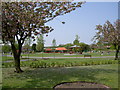
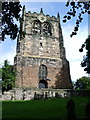
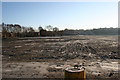
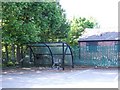
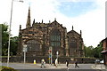
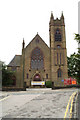
Photos of L39 2XG


Area Information
Living in L39 2XG means inhabiting a tightly knit residential cluster in England, where 2,196 people reside across a compact area. With a population density of 1,120 people per square kilometre, the postcode reflects a small, closely packed community. This area is not a sprawling suburb but a defined cluster of homes, likely centred around local amenities and transport links. Daily life here is shaped by proximity to retail and rail networks, with shops and stations within practical reach. The demographic profile suggests a mature population, with a median age of 47, indicating a mix of long-term residents and families. While the area lacks natural constraints like protected woodlands or wetlands, it is positioned near Ormskirk and surrounding towns, offering a balance of rural tranquillity and commuter accessibility. For those seeking a quiet yet connected lifestyle, L39 2XG provides a snapshot of suburban England, where homes are predominantly owner-occupied and community ties are likely strong.
- Area Type
- Postcode
- Area Size
- Not available
- Population
- 2196
- Population Density
- 1120 people/km²
The property market in L39 2XG is dominated by owner-occupied homes, with 65% of properties in private hands. This contrasts with areas where rental markets dominate, suggesting a community of long-term residents rather than transient tenants. The accommodation type is predominantly houses, which is unusual for smaller postcode areas that often include flats or apartments. This housing stock likely appeals to families or individuals seeking more space, though the area’s small size means the housing stock is limited. For buyers, this implies a niche market with fewer options, but the presence of houses may indicate a focus on traditional, family-friendly properties. The proximity to rail links and retail hubs like Iceland Ormskirk and Lidl Ormskirk adds practical value, though the area’s compact nature means buyers must consider the broader surrounding region for more options.
House Prices in L39 2XG
No properties found in this postcode.
Energy Efficiency in L39 2XG
The lifestyle in L39 2XG is shaped by its proximity to retail and transport hubs. Within practical reach are shops such as Iceland Ormskirk, Lidl Ormskirk, and Co-op Wigan, offering everyday essentials and groceries. These stores cater to a range of needs, from weekly shopping to impulse purchases. The area’s rail network, with stations like Ormskirk and Burscough Junction, provides access to broader regional amenities, including cultural attractions, healthcare facilities, and larger retail centres. While the data does not specify parks or leisure facilities, the absence of environmental constraints like protected woodlands or wetlands suggests open spaces may be limited. Nonetheless, the combination of retail convenience and rail connectivity creates a functional lifestyle, ideal for those prioritising accessibility over expansive green spaces.
Amenities
Schools
| Rank | School | Type | Entry gender | Ages |
|---|
Explore more schools in this area
Go to Schools tabDemographics
The community in L39 2XG is predominantly composed of adults aged 30–64, with a median age of 47. This suggests a population skewed towards middle-aged individuals, possibly reflecting a mix of long-term residents and families. Home ownership is high at 65%, indicating a stable, settled demographic. The accommodation type is primarily houses, which aligns with the area’s residential character and likely contributes to a sense of privacy and space. The predominant ethnic group is White, though specific data on diversity or deprivation is not provided. The age profile implies a community with established careers and family structures, potentially influencing local services and amenities. With no data on income distribution or deprivation, it is unclear how economic factors shape quality of life, but the high home ownership rate suggests a degree of financial stability.
Household Size
Accommodation Type
Tenure
Ethnic Group
Religion
Household Composition
Age
Household Deprivation
NS-SEC
Explore more demographic insights in this area
Go to Demographics tabPlanning
Planning Constraints
- Flood RiskPremium
- Ramsar Wetland SitesPremium
- Area of Outstanding Natural BeautyPremium
- Protected Nature ReservePremium
- Protected WoodlandPremium