Area Overview for L39 2EL
Photos of L39 2EL
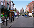
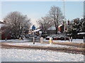
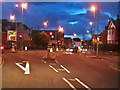
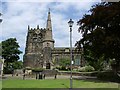
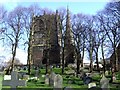
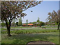
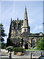
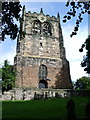
100 photos from this area
Area Information
Key information about the L39 2EL including its size, population, and administrative classification.
- Area Type
- Postcode
- Area Size
- 8323 m²
- Population
- 1557
- Population Density
- 4500 people/km²
House Prices in L39 2EL
32
Properties
£141,095
Average Sold Price
£56,500
Lowest Price
£232,500
Highest Price
Showing 32 properties
| Address | Type | Beds | Baths | Last Sale Price | Last Sale Date | |
|---|---|---|---|---|---|---|
| 117 Burscough Street, Ormskirk, L39 2EL | Terraced | 3 | 1 | £199,000 | Feb 2023 | |
| 107 Burscough Street, Ormskirk, L39 2EL | house | - | - | £232,500 | Aug 2021 | |
| 111 Burscough Street, Ormskirk, L39 2EL | house | 3 | - | £150,000 | Sep 2014 | |
| 67 Burscough Street, Ormskirk, L39 2EL | Terraced | 1 | 1 | £177,000 | Jul 2013 | |
| 113 Burscough Street, Ormskirk, L39 2EL | house | 4 | 1 | £150,000 | May 2007 | |
| 115 Burscough Street, Ormskirk, L39 2EL | Terraced | 3 | 1 | £147,000 | Oct 2006 | |
| 123 Burscough Street, Ormskirk, L39 2EL | Terraced | 3 | 1 | £145,000 | May 2006 | |
| 105 Burscough Street, Ormskirk, L39 2EL | Terraced | - | - | £79,950 | Nov 2001 | |
| 57 Burscough Street, Ormskirk, L39 2EL | Flat | - | - | £74,000 | Mar 2000 | |
| 119 Burscough Street, Ormskirk, L39 2EL | Terraced | - | - | £56,500 | Oct 1999 |
Page 1 of 4
Energy Efficiency in L39 2EL
Amenities
Schools
| Rank | School | Type | Entry gender | Ages |
|---|
Explore more schools in this area
Go to Schools tabDemographics
Household Size
One person
most common
Accommodation Type
Houses
most common
Tenure
43
majority
Ethnic Group
White
most common
Religion
N/A
most common
Household Composition
N/A
most common
Age
22
median
Young Adults (15-29 years)
most common
Household Deprivation
N/A
with no deprivation
NS-SEC
16
in Lower managerial occupations
Explore more demographic insights in this area
Go to Demographics tabPlanning
Planning Constraints
- Flood RiskPremium
- Ramsar Wetland SitesPremium
- Area of Outstanding Natural BeautyPremium
- Protected Nature ReservePremium
- Protected WoodlandPremium