Area Overview for L39 0EQ
Photos of L39 0EQ
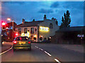
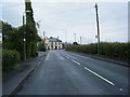
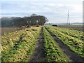
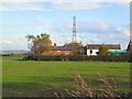
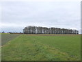
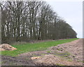
25 photos from this area
Area Information
Key information about the L39 0EQ including its size, population, and administrative classification.
- Area Type
- Postcode
- Area Size
- 9.3 hectares
- Population
- 2158
- Population Density
- 58 people/km²
House Prices in L39 0EQ
41
Properties
£165,679
Average Sold Price
£50,000
Lowest Price
£365,000
Highest Price
Showing 41 properties
| Address | Type | Beds | Baths | Last Sale Price | Last Sale Date | |
|---|---|---|---|---|---|---|
| 95 Liverpool Road, Bickerstaffe, L39 0EQ | house | 2 | 1 | £179,000 | May 2024 | |
| 97 Liverpool Road, Bickerstaffe, L39 0EQ | house | - | - | £90,000 | Mar 2024 | |
| 101 Liverpool Road, Bickerstaffe, L39 0EQ | house | - | - | £130,000 | Feb 2023 | |
| 109 Liverpool Road, Bickerstaffe, L39 0EQ | Terraced | 3 | 1 | £175,000 | Feb 2023 | |
| 141 Liverpool Road, Bickerstaffe, L39 0EQ | Semi-detached | 3 | 1 | £145,000 | Jul 2020 | |
| Lilac Cottage, 115A Liverpool Road, Bickerstaffe, L39 0EQ | Bungalow | 3 | 2 | £285,000 | Oct 2018 | |
| 107 Liverpool Road, Bickerstaffe, L39 0EQ | Cottage | 3 | - | £250,000 | Mar 2018 | |
| 99 Liverpool Road, Bickerstaffe, L39 0EQ | Terraced | 2 | - | £133,000 | Sep 2014 | |
| 129 Liverpool Road, Bickerstaffe, L39 0EQ | house | 3 | - | £150,000 | Nov 2012 | |
| 143 Liverpool Road, Bickerstaffe, L39 0EQ | house | - | - | £162,500 | Sep 2011 |
Page 1 of 5
Energy Efficiency in L39 0EQ
Amenities
Schools
| Rank | School | Type | Entry gender | Ages |
|---|
Explore more schools in this area
Go to Schools tabDemographics
Household Size
Two person
most common
Accommodation Type
Houses
most common
Tenure
80
majority
Ethnic Group
White
most common
Religion
N/A
most common
Household Composition
N/A
most common
Age
47
median
Adults (30-64 years)
most common
Household Deprivation
N/A
with no deprivation
NS-SEC
37
in Lower managerial occupations
Explore more demographic insights in this area
Go to Demographics tabPlanning
Planning Constraints
- Flood RiskPremium
- Ramsar Wetland SitesPremium
- Area of Outstanding Natural BeautyPremium
- Protected Nature ReservePremium
- Protected WoodlandPremium