Area Overview for L37 2EP
Photos of L37 2EP
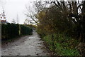
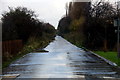

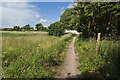
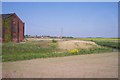

27 photos from this area
Area Information
Key information about the L37 2EP including its size, population, and administrative classification.
- Area Type
- Postcode
- Area Size
- 4.6 hectares
- Population
- 1276
- Population Density
- 3849 people/km²
House Prices in L37 2EP
26
Properties
£408,379
Average Sold Price
£284,000
Lowest Price
£800,000
Highest Price
Showing 26 properties
| Address | Type | Beds | Baths | Last Sale Price | Last Sale Date | |
|---|---|---|---|---|---|---|
| 33 Andrews Lane, Formby, L37 2EP | Detached | 4 | 1 | £350,000 | Mar 2025 | |
| 45 Andrews Lane, Formby, L37 2EP | Detached | 4 | 3 | £405,000 | Aug 2024 | |
| 47 Andrews Lane, Formby, L37 2EP | Detached | 4 | 2 | £470,000 | Apr 2024 | |
| 15 Andrews Lane, Formby, L37 2EP | Detached | 6 | 2 | £800,000 | Mar 2024 | |
| 19 Andrews Lane, Formby, L37 2EP | Detached | 4 | - | £385,000 | Apr 2022 | |
| 49 Andrews Lane, Formby, L37 2EP | Detached | 3 | 3 | £403,000 | Jan 2022 | |
| 21 Andrews Lane, Formby, L37 2EP | Detached | 4 | 1 | £377,500 | Jun 2021 | |
| 65 Andrews Lane, Formby, L37 2EP | Detached | 3 | 2 | £389,995 | May 2021 | |
| 67 Andrews Lane, Formby, L37 2EP | Terraced | 3 | - | £419,995 | May 2021 | |
| 69 Andrews Lane, Formby, L37 2EP | house | - | - | £469,995 | Mar 2021 |
Page 1 of 3
Energy Efficiency in L37 2EP
Amenities
Schools
| Rank | School | Type | Entry gender | Ages |
|---|
Explore more schools in this area
Go to Schools tabDemographics
Household Size
Family (3-5 people)
most common
Accommodation Type
Houses
most common
Tenure
77
majority
Ethnic Group
White
most common
Religion
N/A
most common
Household Composition
N/A
most common
Age
47
median
Adults (30-64 years)
most common
Household Deprivation
N/A
with no deprivation
NS-SEC
42
in Lower managerial occupations
Explore more demographic insights in this area
Go to Demographics tabPlanning
Planning Constraints
- Flood RiskPremium
- Ramsar Wetland SitesPremium
- Area of Outstanding Natural BeautyPremium
- Protected Nature ReservePremium
- Protected WoodlandPremium