Area Overview for L37 2DH
Photos of L37 2DH
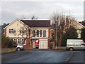
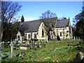
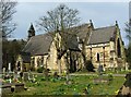
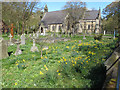
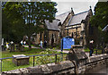
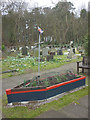
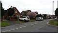
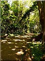
41 photos from this area
Area Information
Key information about the L37 2DH including its size, population, and administrative classification.
- Area Type
- Postcode
- Area Size
- 9098 m²
- Population
- 1416
- Population Density
- 370 people/km²
House Prices in L37 2DH
16
Properties
£188,917
Average Sold Price
£55,000
Lowest Price
£320,000
Highest Price
Showing 16 properties
| Address | Type | Beds | Baths | Last Sale Price | Last Sale Date | |
|---|---|---|---|---|---|---|
| 55 Beechwood Drive, Formby, L37 2DH | Semi-detached | 4 | 2 | £310,000 | Dec 2024 | |
| 49 Beechwood Drive, Formby, L37 2DH | Semi-detached | 3 | 1 | £260,000 | Oct 2018 | |
| 39 Beechwood Drive, Formby, L37 2DH | Semi-detached | 4 | 1 | £225,000 | Jun 2018 | |
| 37 Beechwood Drive, Formby, L37 2DH | Detached | 4 | 2 | £320,000 | Aug 2013 | |
| 45 Beechwood Drive, Formby, L37 2DH | Detached | - | - | £208,000 | Sep 2012 | |
| 53 Beechwood Drive, Formby, L37 2DH | Detached | - | - | £151,000 | Aug 2002 | |
| 61 Beechwood Drive, Formby, L37 2DH | house | 3 | - | £96,250 | Nov 1999 | |
| 57 Beechwood Drive, Formby, L37 2DH | Semi-detached | - | - | £75,000 | Jul 1998 | |
| 43 Beechwood Drive, Formby, L37 2DH | Detached | - | - | £55,000 | Sep 1997 | |
| 47 Beechwood Drive, Formby, L37 2DH | Terraced | - | - | - | - |
Page 1 of 2
Energy Efficiency in L37 2DH
Amenities
Schools
| Rank | School | Type | Entry gender | Ages |
|---|
Explore more schools in this area
Go to Schools tabDemographics
Household Size
Two person
most common
Accommodation Type
Houses
most common
Tenure
94
majority
Ethnic Group
White
most common
Religion
N/A
most common
Household Composition
N/A
most common
Age
47
median
Adults (30-64 years)
most common
Household Deprivation
N/A
with no deprivation
NS-SEC
49
in Lower managerial occupations
Explore more demographic insights in this area
Go to Demographics tabPlanning
Planning Constraints
- Flood RiskPremium
- Ramsar Wetland SitesPremium
- Area of Outstanding Natural BeautyPremium
- Protected Nature ReservePremium
- Protected WoodlandPremium