Area Overview for L36 9XE
Photos of L36 9XE
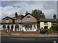
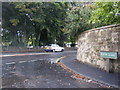
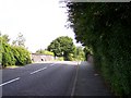
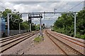
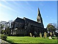
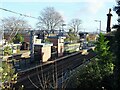
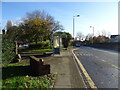
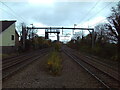
45 photos from this area
Area Information
Key information about the L36 9XE including its size, population, and administrative classification.
- Area Type
- Postcode
- Area Size
- 1.1 hectares
- Population
- 1927
- Population Density
- 4366 people/km²
House Prices in L36 9XE
21
Properties
£197,697
Average Sold Price
£72,000
Lowest Price
£350,000
Highest Price
Showing 21 properties
| Address | Type | Beds | Baths | Last Sale Price | Last Sale Date | |
|---|---|---|---|---|---|---|
| 66 Archway Road, Huyton, L36 9XE | Semi-detached | 3 | 2 | £300,000 | Jun 2025 | |
| 54 Archway Road, Huyton, L36 9XE | house | - | - | £350,000 | Jul 2022 | |
| 56 Archway Road, Huyton, L36 9XE | house | - | - | £250,000 | Dec 2021 | |
| 76 Archway Road, Huyton, L36 9XE | Bungalow | - | - | £265,000 | Mar 2021 | |
| 48 Archway Road, Huyton, L36 9XE | house | - | - | £225,000 | Oct 2020 | |
| 60 Archway Road, Huyton, L36 9XE | Terraced | - | - | £225,000 | Jun 2019 | |
| 62 Archway Road, Huyton, L36 9XE | Semi-detached | 4 | 1 | £200,000 | Aug 2018 | |
| 52 Archway Road, Huyton, L36 9XE | Semi-detached | 3 | 1 | £195,500 | May 2015 | |
| 40 Archway Road, Huyton, L36 9XE | house | - | - | £148,000 | Jul 2014 | |
| 72 Archway Road, Huyton, L36 9XE | Semi-detached | 3 | - | £163,000 | Jul 2014 |
Page 1 of 3
Energy Efficiency in L36 9XE
Amenities
Schools
| Rank | School | Type | Entry gender | Ages |
|---|
Explore more schools in this area
Go to Schools tabDemographics
Household Size
Two person
most common
Accommodation Type
Houses
most common
Tenure
90
majority
Ethnic Group
White
most common
Religion
N/A
most common
Household Composition
N/A
most common
Age
47
median
Adults (30-64 years)
most common
Household Deprivation
N/A
with no deprivation
NS-SEC
38
in Lower managerial occupations
Explore more demographic insights in this area
Go to Demographics tabPlanning
Planning Constraints
- Flood RiskPremium
- Ramsar Wetland SitesPremium
- Area of Outstanding Natural BeautyPremium
- Protected Nature ReservePremium
- Protected WoodlandPremium