Area Overview for L36 9AD
Photos of L36 9AD
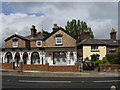
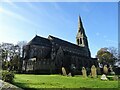
45 photos from this area
Area Information
Key information about the L36 9AD including its size, population, and administrative classification.
- Area Type
- Postcode
- Area Size
- 8366 m²
- Population
- 1927
- Population Density
- 4366 people/km²
House Prices in L36 9AD
30
Properties
£192,297
Average Sold Price
£132,000
Lowest Price
£259,995
Highest Price
Showing 30 properties
| Address | Type | Beds | Baths | Last Sale Price | Last Sale Date | |
|---|---|---|---|---|---|---|
| 44 Springwell Avenue, Roby, L36 9AD | Semi-detached | 3 | 3 | £235,000 | Jan 2022 | |
| 38 Springwell Avenue, Roby, L36 9AD | house | - | - | £225,000 | Sep 2021 | |
| 20 Springwell Avenue, Roby, L36 9AD | house | - | - | £199,000 | Aug 2021 | |
| 52 Springwell Avenue, Roby, L36 9AD | Detached | 3 | 2 | £183,500 | Jun 2021 | |
| 36 Springwell Avenue, Roby, L36 9AD | Detached | 3 | 2 | £234,000 | Jan 2021 | |
| 42 Springwell Avenue, Roby, L36 9AD | Detached | 3 | 2 | £211,000 | Nov 2020 | |
| 50 Springwell Avenue, Roby, L36 9AD | house | - | - | £207,000 | Oct 2020 | |
| 40 Springwell Avenue, Roby, L36 9AD | Semi-detached | 3 | 3 | £175,000 | Sep 2020 | |
| 56 Springwell Avenue, Roby, L36 9AD | Semi-detached | 2 | 1 | £145,000 | Feb 2019 | |
| 12 Springwell Avenue, Roby, L36 9AD | Detached | 3 | 2 | £179,995 | Jun 2018 |
Page 1 of 3
Energy Efficiency in L36 9AD
Amenities
Schools
| Rank | School | Type | Entry gender | Ages |
|---|
Explore more schools in this area
Go to Schools tabDemographics
Household Size
Two person
most common
Accommodation Type
Houses
most common
Tenure
90
majority
Ethnic Group
White
most common
Religion
N/A
most common
Household Composition
N/A
most common
Age
47
median
Adults (30-64 years)
most common
Household Deprivation
N/A
with no deprivation
NS-SEC
38
in Lower managerial occupations
Explore more demographic insights in this area
Go to Demographics tabPlanning
Planning Constraints
- Flood RiskPremium
- Ramsar Wetland SitesPremium
- Area of Outstanding Natural BeautyPremium
- Protected Nature ReservePremium
- Protected WoodlandPremium