Area Overview for L36 8HA
Photos of L36 8HA
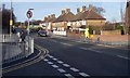

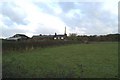
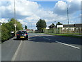
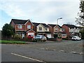
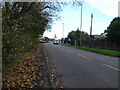
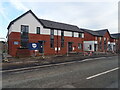
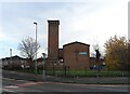

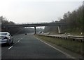

23 photos from this area
Area Information
Key information about the L36 8HA including its size, population, and administrative classification.
- Area Type
- Postcode
- Area Size
- 9785 m²
- Population
- 1401
- Population Density
- 610 people/km²
House Prices in L36 8HA
37
Properties
£94,767
Average Sold Price
£22,500
Lowest Price
£170,000
Highest Price
Showing 37 properties
| Address | Type | Beds | Baths | Last Sale Price | Last Sale Date | |
|---|---|---|---|---|---|---|
| 82 Lyme Cross Road, Huyton, L36 8HA | Semi-detached | 3 | 1 | £170,000 | Nov 2024 | |
| 78 Lyme Cross Road, Huyton, L36 8HA | Terraced | 3 | 1 | £125,000 | Apr 2024 | |
| 54 Lyme Cross Road, Huyton, L36 8HA | house | - | - | £150,000 | Sep 2021 | |
| 80 Lyme Cross Road, Huyton, L36 8HA | Terraced | 3 | 1 | £73,000 | Oct 2019 | |
| 86 Lyme Cross Road, Huyton, L36 8HA | house | 3 | - | £72,500 | Aug 2012 | |
| 68 Lyme Cross Road, Huyton, L36 8HA | house | - | - | £89,950 | Dec 2008 | |
| 38 Lyme Cross Road, Huyton, L36 8HA | Semi-detached | - | - | £90,000 | Dec 2006 | |
| 96 Lyme Cross Road, Huyton, L36 8HA | Semi-detached | - | - | £59,950 | Mar 2004 | |
| 66 Lyme Cross Road, Huyton, L36 8HA | house | - | - | £22,500 | Dec 1995 | |
| 46 Lyme Cross Road, Huyton, L36 8HA | Terraced | 3 | - | - | - |
Page 1 of 4
Energy Efficiency in L36 8HA
Amenities
Schools
| Rank | School | Type | Entry gender | Ages |
|---|
Explore more schools in this area
Go to Schools tabDemographics
Household Size
Family (3-5 people)
most common
Accommodation Type
Houses
most common
Tenure
43
majority
Ethnic Group
White
most common
Religion
N/A
most common
Household Composition
N/A
most common
Age
47
median
Adults (30-64 years)
most common
Household Deprivation
N/A
with no deprivation
NS-SEC
16
in Lower managerial occupations
Explore more demographic insights in this area
Go to Demographics tabPlanning
Planning Constraints
- Flood RiskPremium
- Ramsar Wetland SitesPremium
- Area of Outstanding Natural BeautyPremium
- Protected Nature ReservePremium
- Protected WoodlandPremium