Area Overview for L36 8EH
Photos of L36 8EH
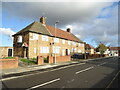
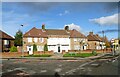
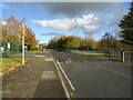
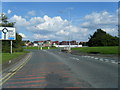
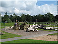

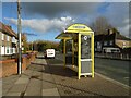
10 photos from this area
Area Information
Key information about the L36 8EH including its size, population, and administrative classification.
- Area Type
- Postcode
- Area Size
- 1.4 hectares
- Population
- 2181
- Population Density
- 3633 people/km²
House Prices in L36 8EH
96
Properties
£136,713
Average Sold Price
£77,000
Lowest Price
£180,000
Highest Price
Showing 96 properties
| Address | Type | Beds | Baths | Last Sale Price | Last Sale Date | |
|---|---|---|---|---|---|---|
| 160 Stockbridge Lane, Huyton, L36 8EH | Semi-detached | 4 | 2 | £180,000 | Oct 2022 | |
| 142 Stockbridge Lane, Huyton, L36 8EH | house | - | - | £147,000 | May 2021 | |
| 138 Stockbridge Lane, Huyton, L36 8EH | Semi-detached | 3 | 2 | £153,000 | May 2021 | |
| 140 Stockbridge Lane, Huyton, L36 8EH | house | - | - | £130,995 | Jun 2015 | |
| 158 Stockbridge Lane, Huyton, L36 8EH | Semi-detached | - | - | £100,000 | Apr 2014 | |
| 134 Stockbridge Lane, Huyton, L36 8EH | house | - | - | £168,995 | Jan 2014 | |
| 190 Hillside Avenue, Huyton, L36 8EH | undefined | - | - | £77,000 | Aug 2009 | |
| 134 Stockbridge Lane, Huyton, L36 8EH | undefined | - | - | - | - | |
| 142 Stockbridge Lane, Huyton, L36 8EH | undefined | - | - | - | - | |
| 136 Stockbridge Lane, Huyton, L36 8EH | undefined | - | - | - | - |
Page 1 of 10
Energy Efficiency in L36 8EH
Amenities
Schools
| Rank | School | Type | Entry gender | Ages |
|---|
Explore more schools in this area
Go to Schools tabDemographics
Household Size
Family (3-5 people)
most common
Accommodation Type
Houses
most common
Tenure
72
majority
Ethnic Group
White
most common
Religion
N/A
most common
Household Composition
N/A
most common
Age
47
median
Adults (30-64 years)
most common
Household Deprivation
N/A
with no deprivation
NS-SEC
29
in Lower managerial occupations
Explore more demographic insights in this area
Go to Demographics tabPlanning
Planning Constraints
- Flood RiskPremium
- Ramsar Wetland SitesPremium
- Area of Outstanding Natural BeautyPremium
- Protected Nature ReservePremium
- Protected WoodlandPremium