Area Overview for L36 7SA
Photos of L36 7SA
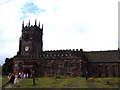
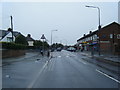
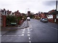
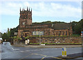
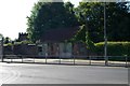
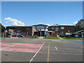
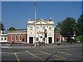
21 photos from this area
Area Information
Key information about the L36 7SA including its size, population, and administrative classification.
- Area Type
- Postcode
- Area Size
- 1.8 hectares
- Population
- 1504
- Population Density
- 4522 people/km²
House Prices in L36 7SA
29
Properties
£97,355
Average Sold Price
£31,000
Lowest Price
£240,000
Highest Price
Showing 29 properties
| Address | Type | Beds | Baths | Last Sale Price | Last Sale Date | |
|---|---|---|---|---|---|---|
| 121 Blue Bell Lane, Huyton, L36 7SA | Terraced | 3 | 1 | £134,000 | Dec 2025 | |
| 127 Blue Bell Lane, Huyton, L36 7SA | Terraced | 3 | 1 | £137,000 | Oct 2025 | |
| 117 Blue Bell Lane, Huyton, L36 7SA | Terraced | 3 | 1 | £134,000 | Apr 2025 | |
| 151 Blue Bell Lane, Huyton, L36 7SA | Terraced | 3 | 2 | £240,000 | Dec 2024 | |
| 119 Blue Bell Lane, Huyton, L36 7SA | Terraced | 3 | 1 | £130,000 | Aug 2024 | |
| 155 Blue Bell Lane, Huyton, L36 7SA | Terraced | 2 | 1 | £182,000 | Dec 2023 | |
| 153 Blue Bell Lane, Huyton, L36 7SA | Terraced | 3 | 2 | £202,500 | Feb 2023 | |
| 123 Blue Bell Lane, Huyton, L36 7SA | Terraced | 3 | 1 | £70,500 | Oct 2017 | |
| 115 Blue Bell Lane, Huyton, L36 7SA | Terraced | 3 | - | £42,500 | May 2015 | |
| 125 Blue Bell Lane, Huyton, L36 7SA | Terraced | 3 | - | £42,500 | May 2015 |
Page 1 of 3
Energy Efficiency in L36 7SA
Amenities
Schools
| Rank | School | Type | Entry gender | Ages |
|---|
Explore more schools in this area
Go to Schools tabDemographics
Household Size
Family (3-5 people)
most common
Accommodation Type
Houses
most common
Tenure
61
majority
Ethnic Group
White
most common
Religion
N/A
most common
Household Composition
N/A
most common
Age
47
median
Adults (30-64 years)
most common
Household Deprivation
N/A
with no deprivation
NS-SEC
22
in Lower managerial occupations
Explore more demographic insights in this area
Go to Demographics tabPlanning
Planning Constraints
- Flood RiskPremium
- Ramsar Wetland SitesPremium
- Area of Outstanding Natural BeautyPremium
- Protected Nature ReservePremium
- Protected WoodlandPremium