Area Overview for L36 7RL
Photos of L36 7RL


Area Information
Living in L36 7RL means being part of a small, tightly knit residential cluster in England, home to 1,301 residents. This area is characterised by its modest size and the presence of family-oriented housing, with a median age of 47 and a population skewed toward adults aged 30–64. Daily life here is shaped by proximity to essential services and a low-risk environment. The area’s safety profile is strong, with a crime risk score of 79 and no significant environmental hazards like flood zones or protected natural areas. Residents benefit from excellent digital connectivity, with a broadband score of 100 and mobile coverage rated 85. Nearby, the cluster of shops, railway stations, and two airports within practical reach ensures convenience for both daily needs and travel. While the community is predominantly White and home ownership stands at 58%, the area’s compact nature fosters a sense of familiarity. For buyers, L36 7RL offers a blend of practicality and stability, with housing stock focused on traditional homes rather than apartments or high-density developments.
- Area Type
- Postcode
- Area Size
- Not available
- Population
- 1301
- Population Density
- 5130 people/km²
The property market in L36 7RL is defined by a 58% home ownership rate, with houses making up the majority of accommodation types. This suggests a residential area where traditional family homes are the norm rather than rental properties or high-density housing. The small size of the postcode area means the housing stock is limited, which could make the market competitive for buyers. With no indication of recent development or new builds, property availability is likely constrained to existing homes. The absence of flats or apartments also means the area is less suited to younger buyers or those seeking more flexible living arrangements. For those prioritising stability and a low-risk environment, the existing housing stock offers a straightforward, predictable market, though buyers may need to look beyond the immediate area for broader options.
House Prices in L36 7RL
No properties found in this postcode.
Energy Efficiency in L36 7RL
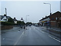
The lifestyle in L36 7RL is shaped by its proximity to essential amenities. Within practical reach are five retail outlets, including Asda Huyton, Tesco Huyton, and Heron Huyton, providing everyday shopping options. The area’s rail network, with five nearby stations, ensures easy access to public transport for commuting or leisure. Two airports, both Liverpool John Lennon, are nearby, facilitating travel. While there is no mention of parks or leisure facilities in the data, the combination of shops, transport links, and low crime risk suggests a functional, low-maintenance lifestyle. The compact nature of the area means residents can access most services without long journeys, though those seeking extensive recreational options may need to venture further.
Amenities
Schools
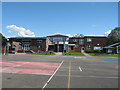
Residents of L36 7RL have access to three special schools: Alt Bridge School, Knowsley Central School, and Albert Hambleton School. These institutions cater to students with specific educational needs, though no Ofsted ratings are provided in the data. The presence of multiple special schools suggests the area may be a draw for families requiring tailored support for children with learning or physical challenges. However, the absence of mainstream primary or secondary schools means parents may need to look further afield for broader educational options. This mix of school types reflects a focus on specialist provision rather than comprehensive education, which could be a consideration for families with diverse needs.
| Rank | School | Type | Entry gender | Ages |
|---|
Explore more schools in this area
Go to Schools tabDemographics
The community in L36 7RL is largely composed of adults aged 30–64, with a median age of 47. Home ownership is at 58%, indicating a balance between owner-occupied properties and rental units. The area is dominated by houses, reflecting a preference for single-family dwellings over flats or apartments. The predominant ethnic group is White, though specific data on diversity or deprivation is not provided. This demographic profile suggests a mature, settled population with established family structures. The low crime risk score of 79, combined with no flood or environmental constraints, implies a stable living environment. However, the lack of detailed diversity metrics means the full range of community experiences remains unexplored. For those considering relocation, the area’s demographics suggest a focus on practical living over urban dynamism.
Household Size
Accommodation Type
Tenure
Ethnic Group
Religion
Household Composition
Age
Household Deprivation
NS-SEC
Explore more demographic insights in this area
Go to Demographics tabPlanning
Planning Constraints
- Flood RiskPremium
- Ramsar Wetland SitesPremium
- Area of Outstanding Natural BeautyPremium
- Protected Nature ReservePremium
- Protected WoodlandPremium