Area Overview for L36 6JQ
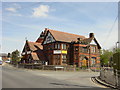
Photos of L36 6JQ


Area Information
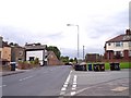
Living in L36 6JQ means being part of a tightly knit residential cluster in England, where 1,834 people reside across 4,830 square metres. The area’s high population density — 379,706 people per square kilometre — reflects its compact nature, with homes clustered closely together. This postcode is characterised by a mature demographic, with a median age of 47 and a majority of residents aged 30–64. Daily life here balances practicality with proximity to essential services. The area’s small size means amenities are within easy reach, though it is not a sprawling suburb. It is a place where families and long-term residents coexist, with a focus on stability and community. While it lacks the sprawling infrastructure of larger towns, its compactness ensures that shops, schools, and transport links are accessible without long commutes. The presence of multiple primary schools and nearby railway stations suggests a deliberate design to support local living. For buyers, this area offers a snapshot of a specific, well-defined community, where the pace of life is measured and the needs of residents are prioritised in planning.
- Area Type
- Postcode
- Area Size
- 4830 m²
- Population
- 1834
- Population Density
- 2381 people/km²
The property market in L36 6JQ is defined by a 47% home ownership rate, indicating that nearly half of the area’s housing stock is rented. This suggests a rental market that coexists with owner-occupied homes, though the exact proportion of rental properties is not specified. The accommodation type is predominantly houses, which is unusual for a small postcode area but may reflect a focus on family homes. Given the area’s compact size, the housing stock is limited, and buyers should consider the scarcity of options. The presence of houses rather than flats or apartments may appeal to those seeking more space, though the high population density implies that properties are closely spaced. For buyers, this area offers a niche market where the availability of homes is constrained, but the focus on houses may suit those prioritising private space over larger developments. The small size of the area means that property searches are likely to be concentrated within a tight radius, with little scope for expansion.
House Prices in L36 6JQ
Showing 1 properties
| Address | Type | Beds | Baths | Last Sale Price | Last Sale Date | |
|---|---|---|---|---|---|---|
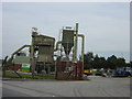
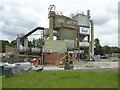
| Vacant Factory Behind Beaman Bathrooms, Wilson Road, Huyton, L36 6JQ | warehouse | - | - | - | - |
Energy Efficiency in L36 6JQ
The lifestyle in L36 6JQ is shaped by its proximity to essential amenities, including retail outlets such as Asda Huyton, Heron Huyton, and Iceland Liverpool. These shops provide access to everyday goods, reducing the need for long trips to larger centres. The area’s rail stations — Huyton, Roby, and Whiston — connect residents to broader transport networks, facilitating travel to work, leisure, or shopping. The presence of two nearby airports, both Liverpool John Lennon Airport, adds to the area’s accessibility for travel. While there is no mention of parks or leisure facilities in the data, the compact layout suggests that public spaces may be limited. The focus on retail and transport implies a practical, service-oriented lifestyle, where convenience is prioritised. Residents can enjoy a balance of local amenities and regional connectivity, though the area’s small size may limit options for more specialised leisure activities.
Amenities
Schools
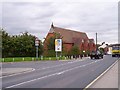
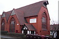
Residents of L36 6JQ have access to several primary schools, including The Sylvester Primary School, St Gabriel’s CofE Primary School, St Agnes Catholic Primary School, and Sylvester Primary Academy. Notably, St Gabriel’s CofE Primary School holds an Ofsted rating of ‘good’, which indicates a satisfactory standard of education. The variety of school types — including Catholic and co-educational institutions — offers families choices aligned with their preferences. The presence of multiple primary schools within proximity suggests a deliberate effort to support local education, reducing the need for long commutes. For families with young children, this cluster of schools provides convenience and a range of curricular options. However, no secondary schools are listed, which may require students to travel to nearby towns for further education. The availability of primary schools is a key consideration for buyers prioritising family-friendly living.
| Rank | School | Type | Entry gender | Ages |
|---|
Explore more schools in this area
Go to Schools tabDemographics
The community in L36 6JQ is predominantly composed of adults aged 30–64, with a median age of 47. This suggests a mature, stable population, likely with established careers and families. Home ownership stands at 47%, indicating a mix of owner-occupied properties and rentals. The accommodation type is primarily houses, which aligns with the area’s compact residential layout. The predominant ethnic group is White, reflecting a homogeneous demographic profile. While no specific data on deprivation or socioeconomic status is provided, the high population density and focus on housing suggest a balance between affordability and demand. The age distribution implies a community with a strong presence of working-age adults, which may influence local services and amenities. The lack of diversity data means the area’s social composition remains largely unexplored in this context, but the figures provided paint a picture of a settled, family-oriented environment.
Household Size
Accommodation Type
Tenure
Ethnic Group
Religion
Household Composition
Age
Household Deprivation
NS-SEC
Explore more demographic insights in this area
Go to Demographics tabPlanning
Planning Constraints
- Flood RiskPremium
- Ramsar Wetland SitesPremium
- Area of Outstanding Natural BeautyPremium
- Protected Nature ReservePremium
- Protected WoodlandPremium