Area Overview for L36 6HE
Photos of L36 6HE
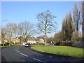

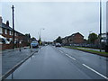
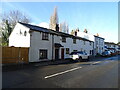
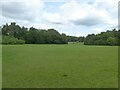
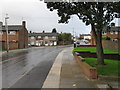


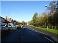


12 photos from this area
Area Information
Key information about the L36 6HE including its size, population, and administrative classification.
- Area Type
- Postcode
- Area Size
- 1.2 hectares
- Population
- 1459
- Population Density
- 3136 people/km²
House Prices in L36 6HE
28
Properties
£80,859
Average Sold Price
£37,950
Lowest Price
£107,000
Highest Price
Showing 28 properties
| Address | Type | Beds | Baths | Last Sale Price | Last Sale Date | |
|---|---|---|---|---|---|---|
| 7 Lynton Road, Huyton, L36 6HE | Terraced | 3 | 1 | £97,500 | Nov 2020 | |
| 41 Lynton Road, Huyton, L36 6HE | Terraced | 3 | 1 | £92,000 | Jul 2020 | |
| 25 Lynton Road, Huyton, L36 6HE | Terraced | 3 | 1 | £70,000 | Sep 2018 | |
| 37 Lynton Road, Huyton, L36 6HE | Terraced | 3 | 1 | £107,000 | Feb 2018 | |
| 27 Lynton Road, Huyton, L36 6HE | house | - | - | £75,000 | Oct 2011 | |
| 15 Lynton Road, Huyton, L36 6HE | house | 3 | - | £82,000 | Oct 2011 | |
| 21 Lynton Road, Huyton, L36 6HE | Terraced | - | - | £85,000 | Oct 2008 | |
| 53 Lynton Road, Huyton, L36 6HE | Terraced | - | - | £91,000 | Dec 2007 | |
| 33 Lynton Road, Huyton, L36 6HE | Terraced | - | - | £55,000 | Apr 2007 | |
| 3 Lynton Road, Huyton, L36 6HE | Terraced | 3 | 1 | £97,000 | Sep 2004 |
Page 1 of 3
Energy Efficiency in L36 6HE
Amenities
Schools
| Rank | School | Type | Entry gender | Ages |
|---|
Explore more schools in this area
Go to Schools tabDemographics
Household Size
Two person
most common
Accommodation Type
Houses
most common
Tenure
57
majority
Ethnic Group
White
most common
Religion
N/A
most common
Household Composition
N/A
most common
Age
47
median
Adults (30-64 years)
most common
Household Deprivation
N/A
with no deprivation
NS-SEC
22
in Lower managerial occupations
Explore more demographic insights in this area
Go to Demographics tabPlanning
Planning Constraints
- Flood RiskPremium
- Ramsar Wetland SitesPremium
- Area of Outstanding Natural BeautyPremium
- Protected Nature ReservePremium
- Protected WoodlandPremium