Area Overview for L36 4QD
Photos of L36 4QD
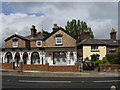


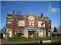
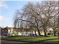
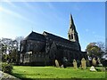
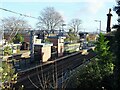
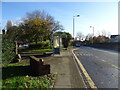
45 photos from this area
Area Information
Key information about the L36 4QD including its size, population, and administrative classification.
- Area Type
- Postcode
- Area Size
- 1.2 hectares
- Population
- 1404
- Population Density
- 4970 people/km²
House Prices in L36 4QD
27
Properties
£219,526
Average Sold Price
£110,000
Lowest Price
£370,000
Highest Price
Showing 27 properties
| Address | Type | Beds | Baths | Last Sale Price | Last Sale Date | |
|---|---|---|---|---|---|---|
| 17 Cheltenham Crescent, Roby, L36 4QD | Bungalow | 3 | 2 | £325,000 | Apr 2025 | |
| 30 Cheltenham Crescent, Roby, L36 4QD | house | - | - | £300,000 | Jan 2025 | |
| 1 Cheltenham Crescent, Roby, L36 4QD | Detached | 4 | 2 | £280,000 | Jan 2023 | |
| 19 Cheltenham Crescent, Roby, L36 4QD | Detached | 4 | 2 | £370,000 | Oct 2022 | |
| 8 Cheltenham Crescent, Roby, L36 4QD | Bungalow | - | - | £200,000 | Mar 2021 | |
| 7 Cheltenham Crescent, Roby, L36 4QD | Detached | 3 | 2 | £225,000 | Jan 2020 | |
| 12 Cheltenham Crescent, Roby, L36 4QD | Bungalow | 3 | 2 | £235,000 | Aug 2019 | |
| 3 Cheltenham Crescent, Roby, L36 4QD | house | - | - | £205,000 | Aug 2014 | |
| 16 Cheltenham Crescent, Roby, L36 4QD | house | - | - | £145,000 | Jan 2014 | |
| 11 Cheltenham Crescent, Roby, L36 4QD | Bungalow | - | - | £157,500 | Jul 2012 |
Page 1 of 3
Energy Efficiency in L36 4QD
Amenities
Schools
| Rank | School | Type | Entry gender | Ages |
|---|
Explore more schools in this area
Go to Schools tabDemographics
Household Size
Two person
most common
Accommodation Type
Houses
most common
Tenure
93
majority
Ethnic Group
White
most common
Religion
N/A
most common
Household Composition
N/A
most common
Age
47
median
Adults (30-64 years)
most common
Household Deprivation
N/A
with no deprivation
NS-SEC
41
in Lower managerial occupations
Explore more demographic insights in this area
Go to Demographics tabPlanning
Planning Constraints
- Flood RiskPremium
- Ramsar Wetland SitesPremium
- Area of Outstanding Natural BeautyPremium
- Protected Nature ReservePremium
- Protected WoodlandPremium