Area Overview for L36 4PH
Photos of L36 4PH
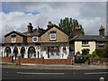
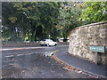
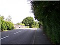
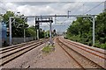
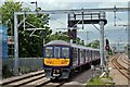
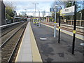
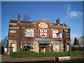
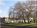
45 photos from this area
Area Information
Key information about the L36 4PH including its size, population, and administrative classification.
- Area Type
- Postcode
- Area Size
- 1.1 hectares
- Population
- 1595
- Population Density
- 5552 people/km²
House Prices in L36 4PH
35
Properties
£95,604
Average Sold Price
£41,000
Lowest Price
£156,000
Highest Price
Showing 35 properties
| Address | Type | Beds | Baths | Last Sale Price | Last Sale Date | |
|---|---|---|---|---|---|---|
| 22 Woodlands Road, Roby, L36 4PH | Terraced | 3 | 3 | £156,000 | Jun 2024 | |
| 8 Woodlands Road, Roby, L36 4PH | house | - | - | £135,000 | Sep 2021 | |
| 32 Woodlands Road, Roby, L36 4PH | house | - | - | £110,000 | May 2021 | |
| 54 Woodlands Road, Roby, L36 4PH | house | - | - | £130,000 | May 2019 | |
| 62 Woodlands Road, Roby, L36 4PH | Terraced | - | - | £120,000 | Aug 2018 | |
| 2 Woodlands Road, Roby, L36 4PH | house | 3 | 1 | £65,500 | Aug 2014 | |
| 48 Woodlands Road, Roby, L36 4PH | house | - | - | £85,000 | Jul 2013 | |
| 38 Woodlands Road, Roby, L36 4PH | Terraced | 3 | 1 | £70,000 | Feb 2012 | |
| 14 Woodlands Road, Roby, L36 4PH | Terraced | - | - | £95,000 | Aug 2009 | |
| 60 Woodlands Road, Roby, L36 4PH | Terraced | 3 | 1 | £120,000 | Mar 2008 |
Page 1 of 4
Energy Efficiency in L36 4PH
Amenities
Schools
| Rank | School | Type | Entry gender | Ages |
|---|
Explore more schools in this area
Go to Schools tabDemographics
Household Size
Family (3-5 people)
most common
Accommodation Type
Houses
most common
Tenure
65
majority
Ethnic Group
White
most common
Religion
N/A
most common
Household Composition
N/A
most common
Age
47
median
Adults (30-64 years)
most common
Household Deprivation
N/A
with no deprivation
NS-SEC
23
in Lower managerial occupations
Explore more demographic insights in this area
Go to Demographics tabPlanning
Planning Constraints
- Flood RiskPremium
- Ramsar Wetland SitesPremium
- Area of Outstanding Natural BeautyPremium
- Protected Nature ReservePremium
- Protected WoodlandPremium