Area Overview for L36 4NS
Photos of L36 4NS
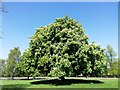
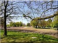
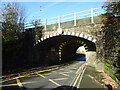
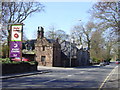
28 photos from this area
Area Information
Key information about the L36 4NS including its size, population, and administrative classification.
- Area Type
- Postcode
- Area Size
- 1.3 hectares
- Population
- 1139
- Population Density
- 7287 people/km²
House Prices in L36 4NS
55
Properties
£124,682
Average Sold Price
£45,750
Lowest Price
£250,000
Highest Price
Showing 55 properties
| Address | Type | Beds | Baths | Last Sale Price | Last Sale Date | |
|---|---|---|---|---|---|---|
| 32 Merton Drive, Roby, L36 4NS | Semi-detached | 3 | 2 | £210,000 | Jun 2024 | |
| 13 Merton Drive, Roby, L36 4NS | house | - | - | £175,000 | Jun 2024 | |
| 55 Merton Drive, Roby, L36 4NS | Semi-detached | 3 | 1 | £190,000 | Mar 2023 | |
| 20 Merton Drive, Roby, L36 4NS | Semi-detached | 4 | 1 | £180,000 | Nov 2022 | |
| 21 Merton Drive, Roby, L36 4NS | Semi-detached | 3 | 1 | £236,000 | Nov 2022 | |
| 34 Merton Drive, Roby, L36 4NS | Semi-detached | - | - | £72,500 | Sep 2022 | |
| 39 Merton Drive, Roby, L36 4NS | Semi-detached | 3 | 1 | £135,000 | Apr 2019 | |
| 47 Merton Drive, Roby, L36 4NS | Semi-detached | 3 | 1 | £108,000 | Sep 2017 | |
| 40 Merton Drive, Roby, L36 4NS | Detached | 3 | 1 | £145,000 | Apr 2017 | |
| 24 Merton Drive, Roby, L36 4NS | Semi-detached | 3 | - | £99,000 | Jan 2017 |
Page 1 of 6
Energy Efficiency in L36 4NS
Amenities
Schools
| Rank | School | Type | Entry gender | Ages |
|---|
Explore more schools in this area
Go to Schools tabDemographics
Household Size
Two person
most common
Accommodation Type
Houses
most common
Tenure
86
majority
Ethnic Group
White
most common
Religion
N/A
most common
Household Composition
N/A
most common
Age
47
median
Adults (30-64 years)
most common
Household Deprivation
N/A
with no deprivation
NS-SEC
31
in Lower managerial occupations
Explore more demographic insights in this area
Go to Demographics tabPlanning
Planning Constraints
- Flood RiskPremium
- Ramsar Wetland SitesPremium
- Area of Outstanding Natural BeautyPremium
- Protected Nature ReservePremium
- Protected WoodlandPremium