Area Overview for L36 4HQ
Photos of L36 4HQ

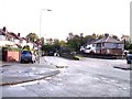

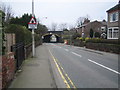

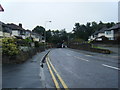
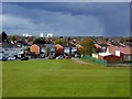

28 photos from this area
Area Information
Key information about the L36 4HQ including its size, population, and administrative classification.
- Area Type
- Postcode
- Area Size
- 2.8 hectares
- Population
- 1612
- Population Density
- 1069 people/km²
House Prices in L36 4HQ
18
Properties
£321,909
Average Sold Price
£187,500
Lowest Price
£510,000
Highest Price
Showing 18 properties
| Address | Type | Beds | Baths | Last Sale Price | Last Sale Date | |
|---|---|---|---|---|---|---|
| 148 Roby Road, Roby, L36 4HQ | Detached | 4 | 1 | £510,000 | Dec 2021 | |
| 156 Roby Road, Roby, L36 4HQ | Detached | 4 | 1 | £332,500 | Jul 2018 | |
| 162 Roby Road, Roby, L36 4HQ | house | - | - | £187,500 | Mar 2018 | |
| 170 Roby Road, Roby, L36 4HQ | Detached | 4 | - | £320,000 | Jun 2017 | |
| 144 Roby Road, Roby, L36 4HQ | Detached | 4 | - | £376,000 | May 2017 | |
| 160 Roby Road, Roby, L36 4HQ | Detached | 4 | 1 | £343,000 | Mar 2017 | |
| 166 Roby Road, Roby, L36 4HQ | Semi-detached | 5 | 3 | £260,000 | Dec 2016 | |
| 154 Roby Road, Roby, L36 4HQ | Detached | 4 | 2 | £247,000 | May 2014 | |
| 146 Roby Road, Roby, L36 4HQ | Detached | 4 | 2 | £319,995 | Feb 2014 | |
| 150 Roby Road, Roby, L36 4HQ | Detached | - | - | £425,000 | Mar 2006 |
Page 1 of 2
Energy Efficiency in L36 4HQ
Amenities
Schools
| Rank | School | Type | Entry gender | Ages |
|---|
Explore more schools in this area
Go to Schools tabDemographics
Household Size
Family (3-5 people)
most common
Accommodation Type
Houses
most common
Tenure
93
majority
Ethnic Group
White
most common
Religion
N/A
most common
Household Composition
N/A
most common
Age
47
median
Adults (30-64 years)
most common
Household Deprivation
N/A
with no deprivation
NS-SEC
43
in Lower managerial occupations
Explore more demographic insights in this area
Go to Demographics tabPlanning
Planning Constraints
- Flood RiskPremium
- Ramsar Wetland SitesPremium
- Area of Outstanding Natural BeautyPremium
- Protected Nature ReservePremium
- Protected WoodlandPremium