Area Overview for L36 3XD
Photos of L36 3XD
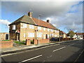
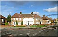
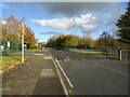
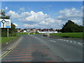
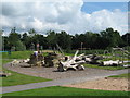

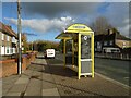
10 photos from this area
Area Information
Key information about the L36 3XD including its size, population, and administrative classification.
- Area Type
- Postcode
- Area Size
- 5075 m²
- Population
- 2181
- Population Density
- 3633 people/km²
House Prices in L36 3XD
18
Properties
£81,318
Average Sold Price
£42,000
Lowest Price
£120,000
Highest Price
Showing 18 properties
| Address | Type | Beds | Baths | Last Sale Price | Last Sale Date | |
|---|---|---|---|---|---|---|
| 163 Parbrook Road, Huyton, L36 3XD | house | - | - | £120,000 | Dec 2021 | |
| 156 Parbrook Road, Huyton, L36 3XD | Semi-detached | 3 | 1 | £100,000 | May 2019 | |
| 157 Parbrook Road, Huyton, L36 3XD | Semi-detached | 3 | 1 | £73,000 | Jun 2017 | |
| 160 Parbrook Road, Huyton, L36 3XD | Semi-detached | 3 | - | £61,000 | Oct 2016 | |
| 171 Parbrook Road, Huyton, L36 3XD | house | - | - | £92,000 | Jul 2008 | |
| 150 Parbrook Road, Huyton, L36 3XD | Semi-detached | - | - | £85,000 | Jul 2007 | |
| 165 Parbrook Road, Huyton, L36 3XD | Semi-detached | 3 | 1 | £97,500 | Jan 2007 | |
| 169 Parbrook Road, Huyton, L36 3XD | Semi-detached | - | - | £87,000 | Dec 2006 | |
| 154 Parbrook Road, Huyton, L36 3XD | Semi-detached | - | - | £88,000 | May 2006 | |
| 159 Parbrook Road, Huyton, L36 3XD | Terraced | - | - | £49,000 | Nov 2003 |
Page 1 of 2
Energy Efficiency in L36 3XD
Amenities
Schools
| Rank | School | Type | Entry gender | Ages |
|---|
Explore more schools in this area
Go to Schools tabDemographics
Household Size
Family (3-5 people)
most common
Accommodation Type
Houses
most common
Tenure
72
majority
Ethnic Group
White
most common
Religion
N/A
most common
Household Composition
N/A
most common
Age
47
median
Adults (30-64 years)
most common
Household Deprivation
N/A
with no deprivation
NS-SEC
29
in Lower managerial occupations
Explore more demographic insights in this area
Go to Demographics tabPlanning
Planning Constraints
- Flood RiskPremium
- Ramsar Wetland SitesPremium
- Area of Outstanding Natural BeautyPremium
- Protected Nature ReservePremium
- Protected WoodlandPremium