Area Overview for L36 3UY
Photos of L36 3UY
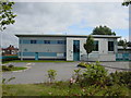

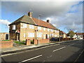
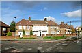
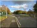


10 photos from this area
Area Information
Key information about the L36 3UY including its size, population, and administrative classification.
- Area Type
- Postcode
- Area Size
- 2.3 hectares
- Population
- 1480
- Population Density
- 5524 people/km²
House Prices in L36 3UY
43
Properties
£74,307
Average Sold Price
£28,000
Lowest Price
£145,000
Highest Price
Showing 43 properties
| Address | Type | Beds | Baths | Last Sale Price | Last Sale Date | |
|---|---|---|---|---|---|---|
| 48 Altmoor Road, Huyton, L36 3UY | Terraced | 3 | 1 | £62,000 | Nov 2025 | |
| 44 Altmoor Road, Huyton, L36 3UY | Terraced | 3 | 1 | £141,000 | Mar 2025 | |
| 20 Altmoor Road, Huyton, L36 3UY | house | - | - | £145,000 | Feb 2025 | |
| 60 Altmoor Road, Huyton, L36 3UY | Terraced | 3 | 1 | £80,000 | May 2020 | |
| 82 Altmoor Road, Huyton, L36 3UY | Terraced | 3 | 1 | £90,000 | Mar 2020 | |
| 38 Altmoor Road, Huyton, L36 3UY | Terraced | 3 | 1 | £130,000 | Oct 2018 | |
| 18 Altmoor Road, Huyton, L36 3UY | house | 3 | 1 | £100,000 | Aug 2018 | |
| 54 Altmoor Road, Huyton, L36 3UY | house | 3 | 1 | £82,500 | May 2017 | |
| 56 Altmoor Road, Huyton, L36 3UY | house | - | - | £90,000 | Mar 2017 | |
| 6 Altmoor Road, Huyton, L36 3UY | Terraced | 3 | 1 | £83,000 | May 2016 |
Page 1 of 5
Energy Efficiency in L36 3UY
Amenities
Schools
| Rank | School | Type | Entry gender | Ages |
|---|
Explore more schools in this area
Go to Schools tabDemographics
Household Size
One person
most common
Accommodation Type
Houses
most common
Tenure
33
majority
Ethnic Group
White
most common
Religion
N/A
most common
Household Composition
N/A
most common
Age
47
median
Adults (30-64 years)
most common
Household Deprivation
N/A
with no deprivation
NS-SEC
15
in Lower managerial occupations
Explore more demographic insights in this area
Go to Demographics tabPlanning
Planning Constraints
- Flood RiskPremium
- Ramsar Wetland SitesPremium
- Area of Outstanding Natural BeautyPremium
- Protected Nature ReservePremium
- Protected WoodlandPremium