Area Overview for L36 1TZ
Photos of L36 1TZ
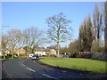

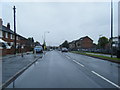
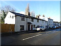
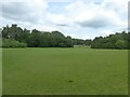
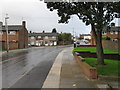
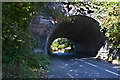
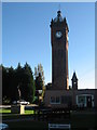
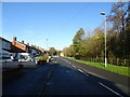


12 photos from this area
Area Information
Key information about the L36 1TZ including its size, population, and administrative classification.
- Area Type
- Postcode
- Area Size
- 1.2 hectares
- Population
- 1463
- Population Density
- 7620 people/km²
House Prices in L36 1TZ
28
Properties
£99,685
Average Sold Price
£38,000
Lowest Price
£175,500
Highest Price
Showing 28 properties
| Address | Type | Beds | Baths | Last Sale Price | Last Sale Date | |
|---|---|---|---|---|---|---|
| 88 Whiston Lane, Huyton, L36 1TZ | Semi-detached | 3 | 1 | £155,000 | Aug 2024 | |
| 92 Whiston Lane, Huyton, L36 1TZ | Semi-detached | 3 | 1 | £175,500 | Mar 2022 | |
| 112 Whiston Lane, Huyton, L36 1TZ | house | - | - | £125,000 | Sep 2021 | |
| 68 Whiston Lane, Huyton, L36 1TZ | house | - | - | £130,000 | Oct 2020 | |
| 66 Whiston Lane, Huyton, L36 1TZ | Semi-detached | 3 | 1 | £155,000 | Jul 2019 | |
| 70 Whiston Lane, Huyton, L36 1TZ | house | - | - | £120,000 | Feb 2014 | |
| 114 Whiston Lane, Huyton, L36 1TZ | house | 3 | - | £95,000 | Aug 2012 | |
| 64 Whiston Lane, Huyton, L36 1TZ | house | - | - | £105,000 | Sep 2009 | |
| 94 Whiston Lane, Huyton, L36 1TZ | Semi-detached | - | - | £64,950 | Feb 2003 | |
| 96 Whiston Lane, Huyton, L36 1TZ | Semi-detached | - | - | £38,000 | Sep 2001 |
Page 1 of 3
Energy Efficiency in L36 1TZ
Amenities
Schools
| Rank | School | Type | Entry gender | Ages |
|---|
Explore more schools in this area
Go to Schools tabDemographics
Household Size
One person
most common
Accommodation Type
Houses
most common
Tenure
58
majority
Ethnic Group
White
most common
Religion
N/A
most common
Household Composition
N/A
most common
Age
47
median
Adults (30-64 years)
most common
Household Deprivation
N/A
with no deprivation
NS-SEC
20
in Lower managerial occupations
Explore more demographic insights in this area
Go to Demographics tabPlanning
Planning Constraints
- Flood RiskPremium
- Ramsar Wetland SitesPremium
- Area of Outstanding Natural BeautyPremium
- Protected Nature ReservePremium
- Protected WoodlandPremium