Area Overview for L36 0TL
Photos of L36 0TL
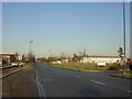
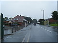


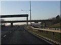

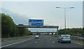
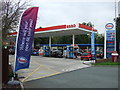
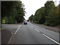
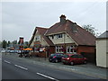
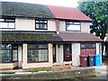
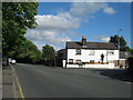
17 photos from this area
Area Information
Key information about the L36 0TL including its size, population, and administrative classification.
- Area Type
- Postcode
- Area Size
- 1.5 hectares
- Population
- 1834
- Population Density
- 2381 people/km²
House Prices in L36 0TL
51
Properties
£103,489
Average Sold Price
£27,250
Lowest Price
£194,000
Highest Price
Showing 51 properties
| Address | Type | Beds | Baths | Last Sale Price | Last Sale Date | |
|---|---|---|---|---|---|---|
| 31 Manley Road, Huyton, L36 0TL | house | - | - | £180,000 | Sep 2025 | |
| 40 Manley Road, Huyton, L36 0TL | Terraced | 3 | 1 | £160,000 | Jun 2025 | |
| 6 Manley Road, Huyton, L36 0TL | Terraced | 2 | 1 | £100,000 | Feb 2025 | |
| 37 Manley Road, Huyton, L36 0TL | Terraced | 3 | 1 | £148,000 | Apr 2024 | |
| 46 Manley Road, Huyton, L36 0TL | Terraced | 3 | 1 | £155,500 | Jan 2023 | |
| 44 Manley Road, Huyton, L36 0TL | Terraced | 2 | 1 | £155,000 | Jan 2023 | |
| 18 Manley Road, Huyton, L36 0TL | Retail | 4 | 1 | £194,000 | Nov 2022 | |
| 48 Manley Road, Huyton, L36 0TL | Terraced | 3 | 1 | £111,165 | Jan 2021 | |
| 3 Manley Road, Huyton, L36 0TL | Terraced | 4 | - | £120,000 | Mar 2019 | |
| 8 Manley Road, Huyton, L36 0TL | Terraced | 3 | 1 | £88,000 | Jul 2018 |
Page 1 of 6
Energy Efficiency in L36 0TL
Amenities
Schools
| Rank | School | Type | Entry gender | Ages |
|---|
Explore more schools in this area
Go to Schools tabDemographics
Household Size
Family (3-5 people)
most common
Accommodation Type
Houses
most common
Tenure
47
majority
Ethnic Group
White
most common
Religion
N/A
most common
Household Composition
N/A
most common
Age
47
median
Adults (30-64 years)
most common
Household Deprivation
N/A
with no deprivation
NS-SEC
22
in Lower managerial occupations
Explore more demographic insights in this area
Go to Demographics tabPlanning
Planning Constraints
- Flood RiskPremium
- Ramsar Wetland SitesPremium
- Area of Outstanding Natural BeautyPremium
- Protected Nature ReservePremium
- Protected WoodlandPremium