Area Overview for L35 8PA
Photos of L35 8PA
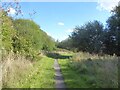
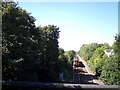
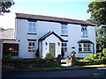


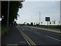
15 photos from this area
Area Information
Key information about the L35 8PA including its size, population, and administrative classification.
- Area Type
- Postcode
- Area Size
- 8000 m²
- Population
- 1394
- Population Density
- 5569 people/km²
House Prices in L35 8PA
24
Properties
£89,840
Average Sold Price
£27,000
Lowest Price
£153,000
Highest Price
Showing 24 properties
| Address | Type | Beds | Baths | Last Sale Price | Last Sale Date | |
|---|---|---|---|---|---|---|
| 100 Longton Lane, Rainhill, St Helens, L35 8PA | house | 3 | 1 | £147,000 | Mar 2022 | |
| 126 Longton Lane, Rainhill, St Helens, L35 8PA | Terraced | 2 | 1 | £93,700 | Feb 2015 | |
| 124 Longton Lane, Rainhill, St Helens, L35 8PA | house | 2 | - | £98,000 | Dec 2013 | |
| 118 Longton Lane, Rainhill, St Helens, L35 8PA | house | - | - | £120,000 | Jul 2009 | |
| 122 Longton Lane, Rainhill, St Helens, L35 8PA | Terraced | 3 | 1 | £153,000 | Jun 2006 | |
| 108 Longton Lane, Rainhill, St Helens, L35 8PA | Semi-detached | - | - | £118,000 | May 2006 | |
| 132 Longton Lane, Rainhill, St Helens, L35 8PA | house | - | - | £115,000 | Aug 2005 | |
| 114 Longton Lane, Rainhill, St Helens, L35 8PA | Terraced | - | - | £116,000 | Aug 2005 | |
| 102 Longton Lane, Rainhill, St Helens, L35 8PA | Terraced | - | - | £115,950 | Mar 2005 | |
| 96 Longton Lane, Rainhill, St Helens, L35 8PA | house | 3 | - | £84,950 | Nov 2002 |
Page 1 of 3
Energy Efficiency in L35 8PA
Amenities
Schools
| Rank | School | Type | Entry gender | Ages |
|---|
Explore more schools in this area
Go to Schools tabDemographics
Household Size
Two person
most common
Accommodation Type
Houses
most common
Tenure
74
majority
Ethnic Group
White
most common
Religion
N/A
most common
Household Composition
N/A
most common
Age
47
median
Adults (30-64 years)
most common
Household Deprivation
N/A
with no deprivation
NS-SEC
29
in Lower managerial occupations
Explore more demographic insights in this area
Go to Demographics tabPlanning
Planning Constraints
- Flood RiskPremium
- Ramsar Wetland SitesPremium
- Area of Outstanding Natural BeautyPremium
- Protected Nature ReservePremium
- Protected WoodlandPremium