Area Overview for L35 6NF
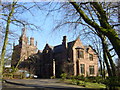
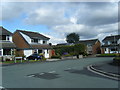
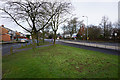
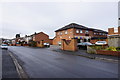
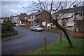
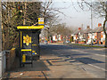
Photos of L35 6NF


Area Information
Living in L35 6NF means being part of a small, tightly knit residential cluster in England. With a population of 1,379 and a density of 615 people per square kilometre, this area is compact yet functional, catering to a community that values stability and local connections. The median age of 47 suggests a mature demographic, with most residents falling between 30 and 64 years old. This age profile indicates a mix of established families and professionals, many of whom own their homes—88% of properties are owner-occupied, reflecting a strong sense of community and long-term residency. The area’s housing stock is predominantly composed of houses, which aligns with its suburban character. While small, L35 6NF offers practical access to nearby amenities, including retail, rail services, and an airport, making it a convenient base for those balancing local living with regional connectivity.
- Area Type
- Postcode
- Area Size
- Not available
- Population
- 1379
- Population Density
- 615 people/km²
The property market in L35 6NF is dominated by owner-occupied homes, with 88% of properties in private ownership. This suggests a stable, long-term resident base rather than a high turnover of rental properties. The accommodation type is primarily houses, which is typical of suburban areas with lower density. Given the small size of the postcode and its classification as a residential cluster, the housing stock is limited, making it a niche market. Buyers should consider the area’s proximity to nearby towns and transport links, which may influence property value trends. The high home ownership rate indicates strong local demand, but the small footprint of the postcode means competition for available homes could be intense for those seeking to move in.
House Prices in L35 6NF
No properties found in this postcode.
Energy Efficiency in L35 6NF
Daily life in L35 6NF is supported by a range of nearby amenities. Retail options include Co-op Rainhill, Asda Warrington, and Morrisons Daily, offering convenience for grocery shopping and everyday needs. The area’s rail stations—Rainhill, Whiston, and Eccleston Park—provide regular connections to surrounding towns and cities, while Liverpool John Lennon Airport is within reach for regional and international travel. These amenities contribute to a lifestyle that balances local convenience with broader connectivity. The mix of retail and transport options ensures that residents can access essentials without needing to travel far, reinforcing the area’s practicality for families and professionals alike.
Amenities
Schools
Residents of L35 6NF have access to a range of educational options. St Bartholomew’s Catholic Primary School, rated ‘good’ by Ofsted, provides a state-funded primary education. For independent schooling, Tower College is a notable option, while Briars Hey and Crossley Manor cater to other educational needs, including special provision. This mix of school types offers flexibility for families, whether they prioritise state education, independent schooling, or specialist support. The presence of both mainstream and special schools ensures that children with diverse learning requirements can be accommodated locally. Parents can choose between a well-rated primary school and independent alternatives, reflecting the area’s capacity to meet varied educational preferences.
| Rank | School | Type | Entry gender | Ages |
|---|
Explore more schools in this area
Go to Schools tabDemographics
The community in L35 6NF is defined by its demographic composition. The median age of 47 and the prevalence of adults aged 30–64 suggest a population that is largely in their prime working and family-raising years. With 88% home ownership, the area is characterised by long-term residents rather than transient renters. The predominant ethnic group is White, which aligns with broader regional patterns. The high home ownership rate and age profile indicate a stable, family-oriented environment, where many residents have built their lives over decades. The absence of specific deprivation data means the area’s quality of life is inferred from its infrastructure and amenities, which appear to meet the needs of its mature, largely settled population.
Household Size
Accommodation Type
Tenure
Ethnic Group
Religion
Household Composition
Age
Household Deprivation
NS-SEC
Explore more demographic insights in this area
Go to Demographics tabPlanning
Planning Constraints
- Flood RiskPremium
- Ramsar Wetland SitesPremium
- Area of Outstanding Natural BeautyPremium
- Protected Nature ReservePremium
- Protected WoodlandPremium