Area Overview for L35 3UF
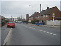
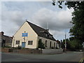
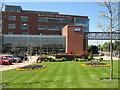
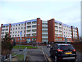
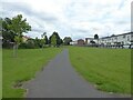
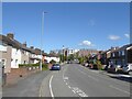
Photos of L35 3UF


Area Information
Living in L35 3UF means being part of a small, tightly knit residential cluster in England, home to 1,114 residents. This area is characterised by its modest size and proximity to essential services, making it ideal for those seeking a quiet, community-focused lifestyle. The demographic profile suggests a stable population, with a median age of 47 and a majority of residents falling within the 30-64 age range. This indicates a mix of middle-aged families and professionals, many of whom own their homes—72% of properties are owner-occupied. The area’s low crime risk, with a safety score of 68/100, adds to its appeal as a secure place to live. While it lacks large-scale amenities, its compact nature ensures residents are close to local shops, schools, and transport links. The absence of environmental constraints such as protected woodlands or AONB designations means development is unlikely to be restricted, though this also means the area’s character remains relatively unchanged. For those prioritising safety, convenience, and a settled community, L35 3UF offers a straightforward, no-frills alternative to more sprawling suburbs.
- Area Type
- Postcode
- Area Size
- Not available
- Population
- 1114
- Population Density
- 1967 people/km²
The property market in L35 3UF is dominated by owner-occupied homes, with 72% of properties owned outright. This high rate of home ownership points to a community of long-term residents rather than a rental-heavy area, which can influence both property values and the dynamics of the local real estate market. The accommodation type is primarily houses, which is unusual for a small postcode area but suggests a focus on family-friendly, spacious living. Given the limited size of the area, the housing stock is likely to be concentrated within a narrow geographic range, making it a niche market for buyers seeking a compact, established neighbourhood. The absence of rental properties means competition for homes may be lower, but it also limits options for those preferring a more flexible tenure. For buyers, this translates to a market where properties are likely to be well-maintained and reflect the priorities of their current owners—practicality, security, and proximity to essential services.
House Prices in L35 3UF
No properties found in this postcode.
Energy Efficiency in L35 3UF
The lifestyle in L35 3UF is shaped by its proximity to essential retail and transport hubs. Within practical reach are retail venues such as Tesco Whiston, M&S Whiston Hospital, and M&S Prescot, providing access to everyday shopping and services. The area’s rail connections, including Whiston and Prescot stations, offer regular links to surrounding towns, enhancing mobility for commuters and shoppers. While the data does not mention parks or leisure facilities, the presence of multiple retail outlets and transport options suggests a practical, service-oriented lifestyle. The compact nature of the area means residents can access amenities without long journeys, though the absence of cultural or recreational venues may limit options for those seeking a more vibrant social scene. For buyers, this implies a straightforward, functional lifestyle focused on convenience rather than luxury.
Amenities
Schools
Residents of L35 3UF have access to three primary schools within practical reach: Halsnead Community Primary School, Whiston Willis Community Primary School, and Whiston Willis Primary Academy. The latter holds an outstanding Ofsted rating, which is a strong indicator of high-quality education for younger children. The presence of multiple primary schools suggests a focus on early education, though no secondary schools are listed in the data. This mix of schools provides families with options for their children’s schooling, though those requiring secondary education may need to look beyond the immediate area. The availability of an outstanding-rated school is a significant advantage for families prioritising academic standards, while the presence of multiple primary schools reduces the need for long commutes. For parents, the proximity of these schools to homes in L35 3UF offers convenience and reassurance about the local educational infrastructure.
| Rank | School | Type | Entry gender | Ages |
|---|
Explore more schools in this area
Go to Schools tabDemographics
The community in L35 3UF is predominantly composed of adults aged 30-64, with a median age of 47. This suggests a population largely settled into careers and family life, with fewer young families or retirees compared to other areas. Home ownership is high at 72%, indicating a stable housing market and a community of long-term residents. The accommodation type is primarily houses, which aligns with the area’s low population density and smaller scale. The predominant ethnic group is White, reflecting a homogenous demographic profile. While this data does not provide specific figures on deprivation, the high home ownership rate and low crime risk suggest a relatively affluent and secure environment. However, the absence of detailed diversity metrics means the full extent of cultural or socioeconomic variation remains unexplored. For buyers, this profile implies a mature, low-maintenance market with properties likely to retain value.
Household Size
Accommodation Type
Tenure
Ethnic Group
Religion
Household Composition
Age
Household Deprivation
NS-SEC
Explore more demographic insights in this area
Go to Demographics tabPlanning
Planning Constraints
- Flood RiskPremium
- Ramsar Wetland SitesPremium
- Area of Outstanding Natural BeautyPremium
- Protected Nature ReservePremium
- Protected WoodlandPremium